Colorado Desert
The Colorado Desert is a subdivision of the larger Sonoran Desert located in southeastern California and extending into Mexico. It is characterized by its extreme aridity and high summer temperatures. The desert is home to a variety of unique plant and animal species adapted to its harsh conditions, including the iconic saguaro cactus and desert bighorn sheep.
4 Key excerpts on "Colorado Desert"
 eBook - ePub
- John C. Krieg(Author)
- 2018(Publication Date)
- CRC Press(Publisher)
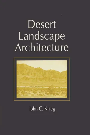
...This gives rise to the deserts of the world. All or parts of the five main North American deserts occur within the territorial boundaries of the U.S. The five American deserts are located predominately between two major mountain ranges. Furthest west representing barrier ranges, are the Sierra Nevadas of California and the Cascades of Oregon and Washington. To the east lie the Great Rocky Mountains. The northernmost of the deserts is the Great Basin Desert. Immediately below the Great Basin is the Mohave Desert. East of the Mohave lies the Painted Desert. Directly south of the Mohave and southwest of the Painted Desert is the Sonoran Desert so named after the Mexican state of Sonora. Situated east of the Sonoran Desert, is the Chihuahuan Desert, again named after the Mexican state of Chihuahua. Diagrams of geographic locations are provided at the end of this chapter. Within any major desert can be found subdeserts which may sometimes differ greatly from their parent environment. Take, for example, the Coachella Valley where I currently live and work. This area occurs in the extreme western end of the Sonoran Desert. This portion of the Sonoran is referred to locally as the Colorado Desert. The Colorado Desert was so named by early Spanish explorers, because the Colorado River serves as its eastern boundary. The Sonoran is the most variable of North American deserts, being either extremely lush, as deserts go, or extremely hot and dry. In terms of mean annual rainfall and temperatures, the Colorado Desert compares favorably with the Great Sahara Desert of North Africa and the Western and Arabian Deserts of the Middle East. What causes the Colorado Desert to be so hot is its low elevation. Several areas within the Coachella Valley itself are below sea level. The town of Thermal, in fact, is more than 100 feet below sea level. Two main factors cause the Colorado Desert to be so dry...
 eBook - ePub
- P. Andrew Jones, Tom Cech(Authors)
- 2009(Publication Date)
- University Press of Colorado(Publisher)
...CHAPTER ONE Colorado Climate, Geology, and Hydrology CLIMATE AND TOPOGRAPHY Introduction The nature of a society is determined, at least in part, by the attributes of the natural setting in which it develops. To understand the story of Colorado water law, one must first explore the windswept peaks, cathedral forests, and sweeping plains that form the state’s landscape. One must meet a mountain stream swollen with snowmelt in a high meadow and follow it down the mountain, through the foothills, and across the broad plain to the horizon. One must look beneath the surface of the earth at the vast, silent formations of rock and sediment, formed in ages past, now holding vast amounts of water suspended in pores and cracks within the rocks. This chapter looks at the constraints and opportunities presented by Colorado’s climate, topography, hydrology, and geology. 1.1 Colorado shaded relief map. Courtesy of the U. S. Geological Survey Colorado is a very large state—the eighth largest of the fifty U.S. states—with 104,000 square miles within its borders. Many nonresidents have a preconceived vision of Colorado as composed of wall-to-wall mountains, sparkling rivers, and snow-covered ski resorts from Julesburg to Rifle. That vision is abruptly altered as one drives along Interstate 76 in northeastern Colorado, passing vistas of sagebrush, prickly pear cactus, and unending treeless prairie. Approximately 40 percent of Colorado’s land area is located in the relatively flat Eastern High Plains. The remaining landscape is almost equally divided between the Central Mountains and the Western Plateaus. Mountains, plains, mesas, and plateaus all combine to make up Colorado (Figure 1.1). Colorado’s climate is one of extremes. For a sportsperson, a good spring day could involve a round of golf in the morning and downhill skiing in the afternoon—both at world-class resorts. What makes this possible is Colorado’s diverse climate, which is shaped by its unique location and topography...
 eBook - ePub
- David M. Armstrong, James P. Fitzgerald, Carron A. Meaney(Authors)
- 2010(Publication Date)
- University Press of Colorado(Publisher)
...They lie in the rain shadow of the mountains and also trap sinking cold air masses for relatively long periods. Western Colorado has a diversity of climates driven in large part by topography. The high plateaus are similar to the mountains, but the lowlands and river valleys are warmer and drier. Winds generally are less intense than on the Eastern Slope. Stable high-pressure systems often form in winter, resulting in long periods of clear weather with warm days and cool nights. Southwestern Colorado typically has monsoonal, or summer, rains. This increase in moisture during the warm season is in contrast to the pattern for the rest of the Western Slope, where the greatest moisture occurs during winter. Erickson and Smith (1985) summarized a vast amount of information on physical environments of Colorado, including climate. A. Benedict (2008) provided an invaluable account of mountain climates. There is no question that climatic patterns are changing at present, in part because of the industrial enrichment of Earth’s atmosphere with “greenhouse gases,” including carbon dioxide released from burning fossil fuels. Colorado, with its high topographic relief and consequent ecological complexity, may expect marked local and regional effects from such changes. Ongoing climate change (which is at least partly anthropogenic) has profound implications for management and conservation of Coloradan mammals; Season’s End (Wildlife Management Institute 2008) is a sobering assessment of impacts of human-influenced climate change on the wildlife populations upon which recreational hunting depends. S. Saunders and Maxwell (2005) summarized likely change in the climate of the West under the theme “less snow, less water.” Summary predictions, all interrelated, were more heat, less snowfall, diminished snowpack, earlier snowmelt, and more wildfires. S. Saunders and Easley (2006) and Saunders et al...
 eBook - ePub
- Michael P. Conzen, Michael P. Conzen(Authors)
- 2014(Publication Date)
- Routledge(Publisher)
...Although this chapter limits itself to areas of extreme moisture defcit—where short-grass prairies give way to xerophytic shrubs (i.e. those adapted to arid conditions) and succulents—there remains a signifcant semantic problem. In physical terms, the most arid areas of the United States are found in the shadow cast by the mountains of the Pacifc coastal ranges. Continentality, cool Pacifc Ocean currents, and high atmospheric pressure systems help explain the aridity of the southwestern and intermountain regions (Figs. 10.1 and 10.2). The culture histories of these regions reveal a keen appreciation of variations in aridity, however, from prehistoric times onward. Initially this meant an understanding of streamfow and channel patterns on perennial tributaries; familiarity with how large rivers inundate their foodplains; discovery of seeps, springs, perched water tables, intermittent creeks, and other favored niches; and, lastly, a knowledge of native plant and animal habitats outside the oases. Prehistoric groups occupied the full range of natural desert landscapes, modifying nature and varying their mix of subsistence activities in tandem with environmental and social change. Figure 10.1 Major desert provinces and case study areas. Figure 10.2 San Felipe Pueblo lands, looking westward from Bernalillo, New Mexico, refect the general aridity of the intermontane region. Experimentation in desert environments continues in various forms during historic times. In each period, deserts are re-explored in light of contemporary human interests, and their nature rediscovered. Early surveys focused on territorial and agricultural opportunities; ways of traveling between and enlarging the oases of the West. Delineations of the desert have often employed crop production indicators, refecting national interests in agricultural settlement (e.g. the 10-inch rainfall boundary, Thornthwaite's aridity index, and the Palmer drought index)...