GPS
GPS, or Global Positioning System, is a satellite-based navigation system that provides location and time information anywhere on Earth. It consists of a network of satellites that transmit signals to GPS receivers, allowing users to determine their precise position. GPS is widely used in geography for mapping, surveying, and navigation purposes.
8 Key excerpts on "GPS"

- Linda L. Lowry(Author)
- 2016(Publication Date)
- SAGE Publications, Inc(Publisher)
...Global Positioning System Global Positioning System Kuldeep Patowary Kuldeep Patowary Patowary, Kuldeep 534 535 Global Positioning System Kuldeep Patowary The Global Positioning System, or GPS, has become an oft-repeated name in 21st-century travel and communication systems around the world. A brainchild of the Department of Defense (DOD) of the United States, it was initially developed as a military tool for tracking various items across the globe. However, the United States has opened up the use of GPS to civilians throughout the world. In layman’s terms, GPS simply provides the user with location-based services with the help of which the user can track his or her movements around the world as well as navigate through a particular area while hiking, cross-country skiing, ballooning, flying, sailing, trekking, and so on. Apart from these, GPS technology has widespread uses in the sphere of science and technology and is used worldwide by scientists to conduct various scientific analyses, such as measuring the movement of Arctic ice sheets, mapping migration patterns of animals and birds, and keeping a tab on the tectonic movement of the Earth’s plates and volcanic activity among others. It is also an indispensable tool in conducting search-and-rescue operations for missing ships and planes. The technology behind the functioning is simple as well as complex. Simply put, the GPS works with the help of a “constellation” of 31 satellites (initially 24), which were put into the orbit by the United States. These satellites move around the earth in six different planes, each of which is tilted at a different angle from the equator. This ensures that the satellites follow a variety of paths, which results in maximum ground coverage...
 eBook - ePub
- Francis Lyall, Paul B. Larsen(Authors)
- 2016(Publication Date)
- Routledge(Publisher)
...The ground terminal receiving equipment is most accurate if signals from three or more satellites are being received. The receivers are pre-programmed to compare the signals and, by integrating the precise times of their reception, to establish where in three dimensions the receiver is located. That data is then mapped onto normal terrestrial cartographic co-ordinates. Suffice it to say that in the near future it will be possible to pinpoint the location of an object or a person to an accuracy of one centimetre. 17 The Systems GPS The US space-based radio navigation system, the Global Positioning System (GPS) 18 was inaugurated by the orbiting of a total of eleven satellites in the period 1978–85, security considerations being a major emphasis in its development. From 1989 to 1994 the system was expanded to its present configuration, and with later satellites being orbited to replace failing ones. The GPS system comprises a minimum of twenty-four satellites in six orbital planes, each with a period of twelve hours in a circular 20,200 km/10,900 nautical miles orbit inclined at 55° (medium Earth orbit, MEO). 19 Currently (2008) seven additional satellites provide an increased accuracy and also can be deployed readily whenever a GPS satellite fails. GPS has a number of ground stations round the world that monitor the system. A master control station at Colorado Springs checks the satellite clocks and orbits and updates the navigation message of each satellite. 20 Any updating message is transmitted to the satellite by a radio signal from ground antennas at the monitoring stations. Two services are provided by GPS, the Standard Positioning Service (SPS) and the Precise Positioning Service (PPS). The Standard Positioning Service is available to all users without restriction, 21 whereas the Precise Positioning Service is available only for US military services, for US government use and for authorised foreign governments and military forces...
 eBook - ePub
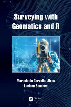
- Marcelo de Carvalho Alves, Luciana Sanches(Authors)
- 2022(Publication Date)
- CRC Press(Publisher)
...Some GPS can display a geoidal model in software; however, the model can be coarse. With the use of GNSS, it has been possible to determine specific positions with high precision and accuracy within crops in agricultural areas. As a result, various observations and measurements can be georeferenced. Decisions about the use of GNSS on farms must be based on particular needs, operational management procedures, and understanding of positioning errors. Other important issues are related to vehicle dynamics, use of pulled implements, and terrain conditions. Proper leveling and alignment, as well as installation of GNSS are necessary for effective operation in tillage. Poor quality of the steering control system, sloping terrain, or lack of implement alignment can affect the performance of the navigation system (Alves and Silva, 2016). 14.4 Global Navigation Satellite Systems The precise distances between satellites and calculation of receiver positions are determined based on timing and signal information. In satellite surveying, satellites become the reference or control stations, and the distances to these satellites are used to calculate receiver positions. In this case, distances and angles can be observed from unknown ground station used to control known point positions (Ghilani and Wolf, 1989; Alves and Silva, 2016). Global positioning systems have been divided into three segments (Schofield et al., 2007; Alves and Silva, 2016): Spatial; Control; User. In the case of the GPS system, the spatial segment consists of 24 satellites operating in six orbital planes spaced at 60 ∘ intervals inclined at 55 ∘ from the Equator. Four additional satellites were kept in reserve as spares...
 eBook - ePub
Archaeological Surveying and Mapping
Recording and Depicting the Landscape
- Philip Howard(Author)
- 2006(Publication Date)
- Routledge(Publisher)
...The satellite location system which is best known is GPS, the Global Positioning System, belonging to the United States Department of Defense. It’s usual to see this as a three-part system, consisting of the space segment (the satellites), the control segment (ground stations), and the user segment (the instruments used by surveyors). The satellites actually bear the name NAVSTAR (Navigation Satellite Timing and Range), the first of which was launched in 1978, though full implementation of GPS was delayed until 1993, partly as a result of the destruction of the space-shuttle Challenger in 1986. When using GPS, it’s easy to forget that the instrument in your hand is only the very fringe of a web of technological complexity which is in some ways very fragile, and which depends for its continuation on not only the expenditure of very large amounts of money, but on global political stability. Although use of GPS has spread rapidly and widely into civilian activities, the system is designed for and controlled by the military, and there is no guarantee of its availability for other users. GPS uses 24 satellites, orbiting the earth at a distance of 20,200km, each orbit taking 12 hours. At least 6 are ‘visible’ (to a receiver, of course they can’t be seen by eye) from any point on the surface at all times. At least, this would be true if the earth was like a billiard-ball, and there were no objects on the surface to obstruct the signals. The satellites are solar powered, with batteries to cover the periods of time when the sun is eclipsed from the position of the satellite. A vital requirement is the provision of accurate timing, and each satellite has four atomic clocks, two rubidium and two caesium. Signals are broadcast at two wavelengths, known as L1 and L2. The L1 wavelengthcarries two code signals, the precise (P) code, which is restricted to military use, and the coarse acquisition (C/A) code, while L2 has just the C/A code...

- Brett Whelan, James Taylor(Authors)
- 2013(Publication Date)
- CSIRO PUBLISHING(Publisher)
...2 Global Navigation Satellite Systems and Precision Agriculture Satellite-based navigation systems are truly the enabling technology of PA. They provide a relatively simple and robust technique for identifying any location on the Earth’s surface or, in the case of aircraft, relative to the surface. This permits agricultural and environmental operations to be geo-referenced and spatially analysed. A wide range of satellite-based navigation and geo-location tools are available to suit different agronomic situations from point crop/soil sampling to autonomous vehicle guidance. Introduction to GNSS Global navigation satellite system (GNSS) is the standard industry term for satellite-based navigation systems that provide geo-spatial positioning on or near the Earth’s surface. While the term GPS has entered the modern vernacular to describe such systems, GPS is actually the moniker for the US NAVSTAR global positioning system. Since the mid 1990s the GPS has been the only fully operational worldwide GNSS. Consequently, the majority of receivers use the information from the NAVSTAR GPS satellites, so this is the system of most interest to agriculture at present. In addition to NAVSTAR GPS, there is the Russian-operated Global’naya Navigatsionnaya Sputnikovaya Sistema (GLONASS). It fell into disrepair in the 1990s but has undergone a full restoration, reaching worldwide coverage at the end of 2011. Both GPS and GLONASS were launched towards the end of the Cold War, primarily for military use. Only later were they adapted for civilian use. They are termed GNSS-1 systems. The widespread adoption of GPS receivers over the past 10–15 years by nonmilitary users has prompted the development of new-generation GNSS, termed GNSS-2 systems, which have a greater focus on civilian applications...
 eBook - ePub
- W Schofield, Mark Breach(Authors)
- 2007(Publication Date)
- CRC Press(Publisher)
...At the individual vehicle level the driver can use GPS as an aid to destination and route location. GPS is used by surveying ships for major offshore hydrographic surveys. Ocean-going liners use it for navigation purposes, whilst most harbours have a DGPS system to enable precise docking. Even recreational craft rely on it almost to the exclusion of traditional methods of navigation and pilotage. At the present time, aircraft landing and navigation are controlled by a variety of disparate systems. GPS is well used and may eventually provide a single system for all aircraft operations. The uses to which GPS can be put are limited only by the imagination of the user. They can range from the complexities of measuring tectonic movement to the simplicity of spreading fertilizer in precision farming, and include many areas of scientific study, such as meteorology, oceanography, and geophysics. As satellite systems continue to develop the applications will continue to grow. 9.19.6 Deformation monitoring The advantage of using GPS is that it enables near real-time monitoring for deformation if data is recorded and processed online. There are a number of such projects currently operational and are described at their respective websites. Examples include monitoring by Nottingham University of the Humber Bridge and a bridge in Nottingham for movement, http://www.gmat.unsw.edu.au/wang/jGPS/v3n12/v3n12p28.pdf. Fig. 9.29 GOCA – GPS-based online Control and Alarm Systems Although GPS can give three-dimensional time-tagged positions at the rate of 10–20 Hz this means that oscillations of more than half this value cannot be easily detected. Since information about actual vibration is of use to engineers the output of other technologies such as accelerometers may be incorporated with that of GPS through mathematical techniques like Kalman filtering...
 eBook - ePub
Global Navigation for Pilots
International Flight Techniques and Procedures
- Dale De Remer, Ph.D., Gary Ullrich(Authors)
- 2020(Publication Date)
- Aviation Supplies & Academics, Inc.(Publisher)
...Also, accurate altitude aiding will replace the need for a fourth satellite. But again, the old rule applies: the more satellites (and ground stations), the more accurate the position calculation. Remember, when the system is fully populated there are five satellites in view anywhere in the world. GPS receivers can determine your location using a combination of satellites and/or fixed stations on the surface of the earth. The receiver knows the distance from the satellite to the receiver and it knows the distance from the center of the Earth to the satellite and the location of the satellite in its orbit around the center of the Earth. Therefore, using spherical trilateration, the receiver can compute its location (LAT/ LON) and distance (altitude) above the center of the Earth. Then, knowing the time from and location of the last computed position, it can determine the speed and direction of travel. Study Questions Which of the GPS errors mentioned in this chapter should be of concern to the pilot? List ten reasons why GPS is a superior navigation system when compared to VOR. What is the farthest north latitude of a GPS satellite’s subpoint? Make a study list of acronyms from the GPS chapter, including their meanings. (Don’t forget AMU!) Name three countries that have their own satellite navigation systems. Some countries are known to spoof the GPS signals in areas where their top political figures are to protect them. Name three tools that pilots can use to defend against this. Name three tools a pilot should/must use before launching on an international flight, as a precaution against GPS errors. Why is ADS-B considered to be a GPS peripheral system? When is it not a GPS peripheral system? Briefly describe the concept of differential GPS....
 eBook - ePub
- Leonid Nadolinets, Eugene Levin, Daulet Akhmedov(Authors)
- 2017(Publication Date)
- CRC Press(Publisher)
...Since 2001, the U.S. Federal Communications Commission (FCC) has required that when Americans call 911 in an emergency that their position be automatically determined to within approximately 125 m. This law, known as E-911 (Enhanced 911), necessitates that mobile telephones be upgraded with this new technology. In the leisure industry, GNSS is becoming increasingly widespread and important. For example, whether hiking, hunting, mountain biking, or windsurfing across Lake Constance in southern Germany, a GNSS receiver provides invaluable information for a great variety of situations. GNSS can essentially be used anywhere on Earth where satellite signal reception is possible and knowledge of position is of benefit. 6.6.1 Description of the Various Applications GNSS-aided navigation and positioning is used in many sectors of the economy, as well as in science, technology, tourism, research, and surveying. GNSS can be utilized wherever precise three-dimensional positional data has a significant role to play. A few important sectors are detailed next. 6.6.1.1 Location-Based Services (LBS) Location-based services (LBS) are services based on the current position of a user (e.g., mobile communications network users equipped with a cellphone). Normally, the mobile station (e.g., cellphone) must be logged on and its position given in order to request or obtain specific information/services from the provider. An example of this is the distribution of local information, such as the location of the nearest restaurant or automatically providing the caller position to emergency number services (E-911 or E-112). The prerequisite for LBS is the determination of accurate position information...