- 128 pages
- English
- ePUB (mobile friendly)
- Available on iOS & Android
eBook - ePub
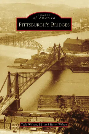
Pittsburgh's Bridges
About this book
Pittsburgh's Bridges takes a comprehensive look at the design, construction, and, sometimes, demolition of the bridges that shaped Pittsburgh, ranging from the covered bridges of yesterday to those that define the skyline today.
Pittsburgh is the "City of Bridges," and what remarkable bridges they are! The area's challenging topography of deep ravines and mighty rivers - the Monongahela, Allegheny, and Ohio - set the stage for engineers, architects, and contractors to conquer the terrain with a variety of distinctive spans. Many were designed to be beautiful as well as functional. While other cities may have one signature bridge, Pittsburgh has such a wide variety that no single bridge can represent it.
Tools to learn more effectively

Saving Books

Keyword Search

Annotating Text

Listen to it instead
Information
One
POINT BRIDGES
Throughout history, places where rivers met often became strategic locations. In the 1700s, the French, Native Americans, and British fought for control of the land at the “Forks of the Ohio,” where the Allegheny and Monongahela Rivers join to form the Ohio River. Ownership of the forks was critical to controlling westward expansion. The French built Fort Duquesne there in 1754, but the British captured it and constructed Fort Pitt in 1758. The settlement that grew around the fort became Pittsburgh.
When Pittsburgh was incorporated as a city in 1816, it had no river bridges, but this soon changed. The city’s first bridges were built over the Monongahela River at Smithfield Street in 1818 and over the Allegheny River at Sixth Street in 1819. By 1870, bridges at eight other locations had been constructed within the city’s present-day boundaries. All were to the east, upriver from the Point. The Point was not a great location for bridges—the ground, low and swampy, often flooded.
The first bridge at the Point, authorized in 1846, was proposed to be a Y-shaped structure connecting the Point with both shores of the Ohio River. It failed to attract sufficient investment, and merchants feared the bridge would be an obstruction to river traffic. After a proposal for a similar bridge failed in 1871, two toll bridges were constructed over the Allegheny and Monongahela Rivers from 1875 to 1877, intersecting at the Point. These bridges greatly improved access to western communities and provided an Ohio River crossing, albeit indirect, that bypassed downtown.
Since Pittsburgh began at the Point, the bridges there became more than just functional crossings—they became part of the city’s skyline and character. The progression of bridges at the Point illustrates how the city’s bridges evolved from being merely utilitarian structures to edifices thoughtfully designed to symbolize a city’s vision—in the case of Pittsburgh, the “Golden Triangle.”
This chapter tells the story of how the bridges at the Point changed over time through the efforts of engineers, architects, urban planners, public officials, business leaders, and involved citizens.

This 1896 photograph shows the first generation of bridges at the Point. The 1875 Union Bridge (left) crosses the Allegheny River. The 1877 Point Bridge (center) crosses the Monongahela. The Duquesne Heights Incline can be seen at lower right. It was located to connect the bridge with the top of Coal Hill (Mount Washington) and was completed one month after the bridge. (Carnegie Library of Pittsburgh.)

This view of the Point in 1947 shows the second generation of bridges. The previous ones were replaced with the 1915 Manchester Bridge (left) over the Allegheny River and the 1927 Point Bridge (right) over the Monongahela River. The photograph shows the booming postwar city a few years before the Renaissance I urban renewal projects led to drastic changes. Only a small park existed at the Point. (Carnegie Library of Pittsburgh.)

The transition from the second to the third generation of bridges is seen here in 1969. The 1963 Fort Duquesne Bridge (just above center) is upriver from the Manchester Bridge, and the 1959 Fort Pitt Bridge (far right) is upriver from the Point Bridge. The photograph shows most of the Renaissance I projects completed or under construction, including Three Rivers Stadium (left). (Carnegie Library of Pittsburgh.)

This 2015 photograph shows how Pittsburgh has evolved since the Renaissance I vision for the city was completed in the 1970s, with the Point Park fountain as its focal point. The third-generation Point bridges delineate the Golden Triangle. While much has changed, the 1877 Duquesne Incline (lower right), which once connected the original Point Bridge to Mount Washington, remains in operation.

The first bridge to be constructed at the Point was the Union Bridge over the Allegheny River. It connected Allegheny City (now Pittsburgh’s North Side) with the tip of the Point. The 1875 bridge was the last wooden covered river bridge built in Pittsburgh. It had grand Italianate neo-Renaissance portals with simulated stonework. (Carnegie Library of Pittsburgh.)

The Union Bridge was a hindrance to navigation on the Allegheny River, as its clearance dropped to as little as seven feet when the water was high. A petition to the US secretary of war in 1902 resulted in the bridge being declared an obstruction to navigation. On appeal, the Supreme Court ruled the bridge had to be raised or razed. The bridge was demolished in 1907. (Carnegie Library of Pittsburgh.)

The Point Bridge Company was chartered in December 1874 to span the Monongahela River. The company faced the challenge of satisfying navigational interests that controlled the Monongahela while designing an economical bridge. The resulting suspension bridge had an 800-foot main span and a vertical clearance of up to 83 feet above low water. Land at the Point had to be raised to form the bridge approach. (Library of Congress.)

The American Bridge Company of Chicago submitted the winning proposal for the Point Bridge. Suspension bridge decks are usually stiffened to provide rigidity, which is costly. The Point Bridge had a novel design in which the catenaries were stiffened by trusses, allowing the bridge to be built for half the cost of comparable bridges. Pittsburgh Locomotive Works in Allegheny City (North Side) manufactured the eyebars. (Carnegie Library of Pittsburgh.)

The second generation of Point bridges began with the construction of the Manchester Bridge from 1911 to 1915 over the Allegheny River. This replaced the Union Bridge, which was demolished in 1907. The American Bridge Company constructed the northern span first, then the southern span, which is shown here under construction in July 1913. The two spans were constructed at different times in order to keep the river channel open for navigation. (Pittsburgh Department of Public Works.)

This August 1913 photograph shows riveting in progress on the Manchester Bridge. Steel members were fastened together using metal pins, called rivets. The rivets were heated in portable forges (foreground) or larger furnaces (background) along the bridge deck until they were red hot. Workers at the forges tossed the hot rivets up to the men on the scaffolding, who hammered them into place....
Table of contents
- Cover Page
- Title Page
- Copyright Page
- Dedication
- Table of Contents
- Acknowledgments
- Introduction
- 1. Point Bridges
- 2. Allegheny River Bridges
- 3. Monongahela River Bridges
- 4. Ohio River Bridges
- 5. Ravine Bridges
- 6. City Beautiful Bridges
- 7. Railroad Overpasses
- 8. Footbridges
Frequently asked questions
Yes, you can cancel anytime from the Subscription tab in your account settings on the Perlego website. Your subscription will stay active until the end of your current billing period. Learn how to cancel your subscription
No, books cannot be downloaded as external files, such as PDFs, for use outside of Perlego. However, you can download books within the Perlego app for offline reading on mobile or tablet. Learn how to download books offline
Perlego offers two plans: Essential and Complete
- Essential is ideal for learners and professionals who enjoy exploring a wide range of subjects. Access the Essential Library with 800,000+ trusted titles and best-sellers across business, personal growth, and the humanities. Includes unlimited reading time and Standard Read Aloud voice.
- Complete: Perfect for advanced learners and researchers needing full, unrestricted access. Unlock 1.4M+ books across hundreds of subjects, including academic and specialized titles. The Complete Plan also includes advanced features like Premium Read Aloud and Research Assistant.
We are an online textbook subscription service, where you can get access to an entire online library for less than the price of a single book per month. With over 1 million books across 990+ topics, we’ve got you covered! Learn about our mission
Look out for the read-aloud symbol on your next book to see if you can listen to it. The read-aloud tool reads text aloud for you, highlighting the text as it is being read. You can pause it, speed it up and slow it down. Learn more about Read Aloud
Yes! You can use the Perlego app on both iOS and Android devices to read anytime, anywhere — even offline. Perfect for commutes or when you’re on the go.
Please note we cannot support devices running on iOS 13 and Android 7 or earlier. Learn more about using the app
Please note we cannot support devices running on iOS 13 and Android 7 or earlier. Learn more about using the app
Yes, you can access Pittsburgh's Bridges by Todd Wilson PE,Helen Wilson in PDF and/or ePUB format, as well as other popular books in Historia & Arquitectura general. We have over one million books available in our catalogue for you to explore.