- English
- ePUB (mobile friendly)
- Available on iOS & Android
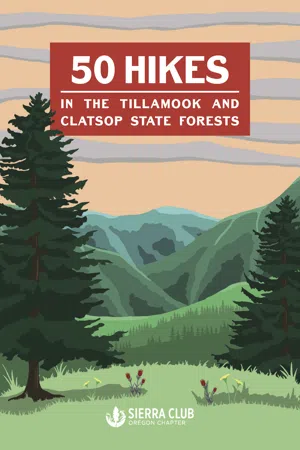
50 Hikes in the Tillamook and Clatsop State Forests
About this book
50 Hikes in the Tillamook and Clatsop State Forests is a guidebook highlighting the adventurous hiking trails within these state forests, ultimately promoting the conservation of these wondrous regional landscapes.
50 Hikes in the Tillamook and Clatsop State Forests provides hikers the chance to explore and experience the ever-changing environments of these forests through the studied eyes of the Sierra Club. This updated edition contains current trail information, path descriptions, driving directions, and regional history on some of Oregon's lushest yet unexplored trails. 50 Hikes includes a new introduction written by Daniel O'Neil, which details the history of this wondrous region; a foreword by Robert Kentta, cultural resources director of the Confederated Tribes of Siletz Indians; original illustrations of its plant life; and photographs collected by Sierra Club members. Readers will be imbued with a full sense of wonder for these forests. From coastal plains to canopied forests, 50 Hikes celebrates the adventurous landscapes of Northwest Oregon by revisiting the Sierra Club's iconic 2001 guidebook.
Tools to learn more effectively

Saving Books

Keyword Search

Annotating Text

Listen to it instead
Information
Wilson River
Corridor
Wilson River Overview
1. Wildcat Mountain

Difficulty
Trailhead Coordinates
Distance
Elevation
Suggested Maps
Getting There

2. Gales Creek


Difficulty
Trailhead Coordinates
Distance
Elevation
Suggested Maps

Getting there
Table of contents
- Non-Liability Statement
- Foreword
- A Message from the Sierra Club
- Introduction
- Important Information about the Tillamook and Clatsop State Forests Hikes
Frequently asked questions
- Essential is ideal for learners and professionals who enjoy exploring a wide range of subjects. Access the Essential Library with 800,000+ trusted titles and best-sellers across business, personal growth, and the humanities. Includes unlimited reading time and Standard Read Aloud voice.
- Complete: Perfect for advanced learners and researchers needing full, unrestricted access. Unlock 1.4M+ books across hundreds of subjects, including academic and specialized titles. The Complete Plan also includes advanced features like Premium Read Aloud and Research Assistant.
Please note we cannot support devices running on iOS 13 and Android 7 or earlier. Learn more about using the app