![]()
CHAPTER 1
BEGINNINGS
Before the Canal Era
Until the mid-eighteenth century British trade and commerce depended on roads and rivers for transport, or in areas near the sea, coastal shipping. Roads were poor, often only rough tracks, until the first turnpike road of 1683 started a programme of improvements over the next century. Carriage was by pack horse or horse-drawn wagon. Rivers were subject to floods and droughts; coastal sailing craft were dependent on wind and tides, good harbours and, of course, the weather. Passengers travelled on horse-back or by stage-coach, or where possible by river boat or by sea.
In south Lancashire, the principal trading artery was the River Mersey, particularly after 1721 when the Mersey & Irwell Navigation Company began straightening and improving the two rivers between Liverpool and the growing industrial area around Manchester, eventually leading to the opening of the Manchester Ship Canal in 1885.
Further north in the county the River Douglas was progressively made navigable from the mouth of the Ribble estuary to Wigan, principally to carry coal down to the coast and thence to ports in Cheshire, Lancashire and Westmorland, with return cargoes of manufactured goods and imports, mainly from Liverpool, and stone and slate from the north. They were carried in flat-bottomed sailing barges called ‘flats’, small at first but by the nineteenth century loading up to 100 tons. As well as coastal trading, they went as far as Ireland and the Isle of Man. Their dimensions were largely dictated by the capacity of other navigations in north-west England.
Estuaries
The Ribble estuary was navigable to Preston as early as 1360, but was hindered by shifting sands until a channel was dredged in 1838. On the north bank a shallow creek could take flats to a wharf at Freckleton, opened in 1738, and in 1842 a small dock was opened at Lytham. Later, more improvements were made to the Ribble, culminating in the opening of Preston Dock in 1892, at that time the largest single dock basin in the world.
Further north, the Wyre estuary was navigable to Hambledon and Skippool from at least the mid-1600s to about 1870, when it was finally supplanted by Fleetwood at its mouth. In north Lancashire, the tidal River Lune was navigable to Lancaster, where the Lancaster Port Commission was established by an Act of 1749 and began constructing St. George’s Quay. Earlier, about 1700, a jetty was constructed at Sunderland Point on the north bank close to the sea, but it could only be used at high tide. Like the Ribble, the Lune estuary was severely hampered by shifting sands and silting. An attempt to alleviate these difficulties was made when, in 1787, the commissioners opened a dock at Glasson, some five miles south of Lancaster, where there was a deeper channel, but the intervening roads were poor. A further attempt to improve access to Lancaster was made in 1799, when a ship canal was proposed from Thornbush, a mile nearer the sea than Glasson and capable of taking large craft to Lancaster, but although money was raised, it was a time of economic depression and the Port Commission was in debt. The scheme was finally abandoned in 1813. As the size of ships grew, so Lancaster’s decline as a port continued.
For sea-going trade, Kendal relied on Milnthorpe, where small craft could penetrate on the tide up the River Beela for about a mile from the River Kent estuary and Morecambe Bay, together with Sandside and several places on the estuary itself from Arnside to Blackstone Point. Most vessels were beached for loading and unloading into carts on the sands between tides, although several stone quays were built. Others discharged into lighters bound for Milnthorpe. But they, too, were dependent on the tides and subject to changing channels. On the opposite side of the Kent, Meathop and Grange-over-Sands also served Kendal. Outward cargoes were mainly slate, limestone and woollen goods, with Wigan coal from the Douglas as the principal import.
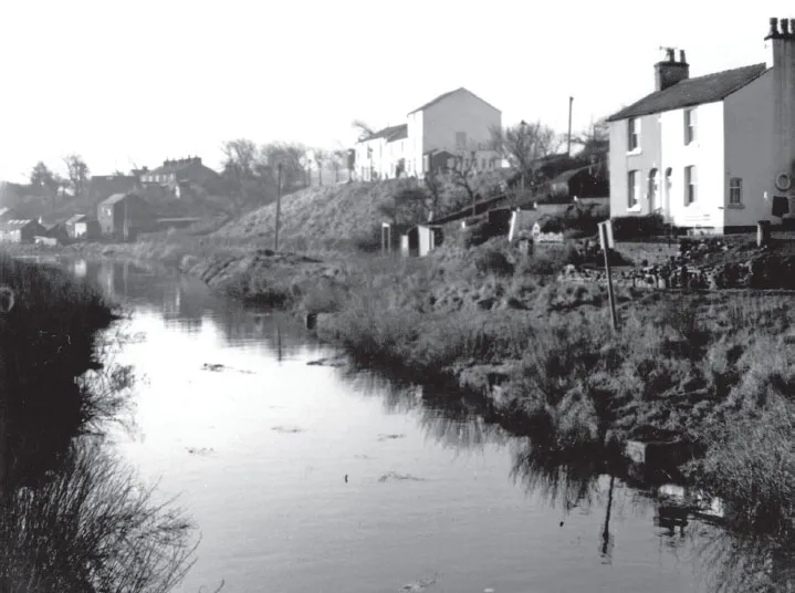
Remains of the wharf on Freckleton Creek, 1967.
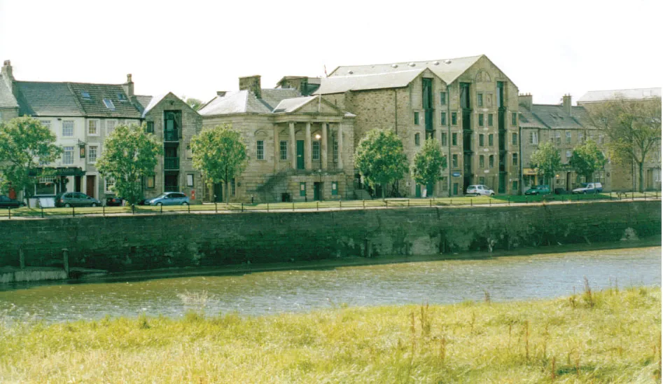
The Custom House and Warehouse on St George’s Quay, Lancaster, 2003.
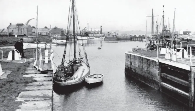
Glasson Dock in the 1930s, from an old postcard.
Conjectural route of John Longbothom’s canal and land reclamation scheme around Morecambe Bay, 1787, see page 13.
The Canal Mania
The first known navigable artificial waterway in Britain was the Roman Fossdyke in Lincolnshire, although its primary purpose was a drainage channel. It was followed in 1566 by the short Exeter Canal, built to avoid the estuary of the Exe up to the city. It was 1745 before another wholly artificial navigation was attempted; the Newry Canal in Ireland, closely followed by the short St. Helens Canal in 1757, built to take coal from south Lancashire to the Mersey. Eight years later, in 1765, the Duke of Bridgewater opened his celebrated canal to convey coal from his mines at Worsley to the rapidly growing industrial towns of Manchester and Salford, extending to the Mersey at Runcorn in 1776.
Industrialisation was growing fast, especially in Lancashire. The Bridgewater Canal clearly showed the superiority of canal transport over roads and rivers; safer, more reliable and, most importantly, faster. Alongside the development of steam power, canals can be said to have begun the real Industrial Revolution as the so-called Canal Mania took hold. By 1840 there were some 4,000 miles of inland navigation in Britain, joining the Mersey, the Humber, the Thames, the Bristol Channel and beyond. After 1840, competition from the new railways began to bite and after about 1850 the canal era entered slow decline.
The canals and river navigations were built by separate companies, of which at the end of the canal era there were over two hundred, in some areas competing with one another. Many canals, especially in the Midlands, were ‘narrow’, capable of taking craft 70ft long but only 7ft wide, hence the term ‘narrowboat’. Others, particularly those connected to rivers, were ‘broad’, taking wider barges with greater capacity.
Apart from a few trunk routes, most canal companies were local promotions, and in order to build them an Act of Parliament was needed, principally to gain powers to compulsorily purchase land on an approved route. They operated similarly to toll roads, open to independent carriers on payment of a toll that was specified in the Act. Having been authorised by an Act of Parliament, any subsequent changes a canal company wished to make frequently required a further Act. Towards the end of the nineteenth century, several larger canal companies set up their own carrying fleets.
The Canal Mania produced a number of schemes in south Lancashire. The most ambitious was the Leeds & Liverpool, a cross-Pennine waterway aiming to link the navigable River Aire at Leeds, and thence the Humber, with the Mersey. It was incorporated by an Act of 1770 but after many vicissitudes was not completed until 1816. Its projected route from Liverpool through south and east Lancashire lay by way of Ormskirk, Leyland and west of Blackburn to join the Ribble Valley, thence following the Lancashire Calder and Pendle Water to Colne before entering Yorkshire. At Newburgh, near Ormskirk, it was proposed to cross the River Douglas navigation on an aqueduct, but later connected with it in order to gain access to the Wigan coalfield, eventually acquiring it outright. A connection with the Bridgewater Canal near Leigh would link it to projected canals around Manchester, and eventually southward to the Midlands. As we shall see later, the Lancashire section was to change.
The first proposal
Further north, manufacturing and mercantile interests in Preston, Lancaster and Kendal for long had been seeking a reduction in the high price of coal brought down the Douglas to the Ribble estuary and thence to Preston, or around the coast to the Lune or across Morecambe Bay to Milnthorpe. A forerunner of the Leeds & Liverpool was a cross-Pennine ‘Grand Canal’ scheme of 1766 linking the Ribble with the Aire, and by numerous branches, the Mersey with the Humber, one branch running from Preston to Lancaster. Although Lancaster men had refused to support both it and a 1769 proposal for a canal linking the Bridgewater to Lancaster, they saw that a south-to-north canal from the Leeds & Liverpool could provide the answer for cheaper coal. A return traffic was available in limestone from Westmorland and north Lancashire for burning into lime for mortar in building and for use as an agricultural fertiliser which was in demand in the Fylde and on the west Lancashire plain.
Accordingly, a group of Lancaster merchants took the lead and called a meeting on 13 November 1771, when it was decided to ask the pioneer canal engineer James Brindley to survey a route. But Brindley was too busy, and delegated the work to his assistant, Robert Whitworth, who later made his own name as a canal engineer. It was not an easy route, cutting across the grain of the country, requiring aqueducts over numerous streams and rivers, two of them major; the Ribble and the Lune. They presented obstacles that Whitworth’s successors would also encounter.
In the following year, he submitted plans for a canal from the projected Leeds & Liverpool at Eccleston near Chorley to Kendal. It would cross the Ribble below Penwortham Bridge at Preston, then loop westward almost to Kirkham before turning back close to Barton and continuing northward to the Lune, which it crossed below Skerton Bridge at Lancaster, and then forward to Tewitfield, north of Carnforth.
Thus far the canal would be level for 54½ miles before rising 86ft by locks to a further level of 18 miles to Kendal. Large aqueducts would be required to cross the Ribble and the Lune, and a tunnel under Hincaster Hill, five miles from Kendal, in order to serve the Wakefields’ gunpowder mills at Sedgwick. Asked to find an easier route with a shorter aqueduct over the Lune, Whitworth responded by suggesting crossing the Ribble by a smaller structure, but needing locks rising 24ft; a shorter westward loop; and another one east of Lancaster to Halton in order to achieve a shorter aqueduct over the Lune. Because this line would be lower, a second set of locks would be required at Tewitfield, rising a further 62 ft. The total distance to Kendal would be increased by only ½ mile, but with eight more locks. Additionally, the canal would not pass as close to Preston and Lancaster as in his original scheme. After that, nothing happened for twenty years.
Other Schemes
However, north of Lancaster other minds were not idle. In 1779, a survey was made for a canal from Ingleton and Burton-in-Lonsdale where there was coal, to the Lune at Conder Green near Lancaster, followed a year later with an extension to Settle. Six years afterwards, in 1787, John Wilkinson, the pioneer ironmaster of Castle Head near Lindale in south Westmorland, enthusiastically proposed a remarkable scheme to enclose and drain 38,710 acres of sand and marsh on the east and north sides of Morecambe Bay and to create a coast-wise canal, using the excavated material to form an embankment. The idea appears to have originated from John Jenkinson of Yealand. John Longbothom, the first engineer of the Leeds & Liverpool Canal, was asked to survey. He went further and proposed that, in addition, the River Winster should be diverted into an artificial channel from the point where it entered the Kent estuary near Castle Head across Foulshaw Moss to rejoin the Kent near Nether Levens. From there the Kent itself would be diverted into a second coast-wise channel to Arnside, from where it would cut across country behind Arnside Knott to Warton Crag. There it would rejoin the coast and pass close to the present-day Carnforth and Morecambe to deep sea at Heysham Head; an ambitious scheme of some 24 miles, which Longbothom costed at £150,000, see map on page 11. In addition to reclaiming extensive areas of Morecambe Bay, he pointed out that the channel could be navigable from the Kent to Bare – now part of Morecambe – from where a short canal could be cut for about three miles to the Lune at Lancaster, thereby simultaneously providing easily navigable water from the sea to Lancaster avoiding the shallow Lune, reviving Lancaster as a port, and creating navigable water to within six miles of Kendal. Wilkinson offered to invest £50,000, while Jenkinson, in seeking support from Lord George Cavendish of Holker Hall, went on to suggest that it would be easy to build a branch canal to Kendal itself. Apparently neither Jenkinson nor Wilkinson were able to convince his lordship, as no more seems to have been heard of the scheme.
During this period, leading Lancaster citizens were becoming increasingly vocal for a canal from the south, now considered a necessity if the city was to compete with growing towns south of the Ribble. On 8 June 1791, at a meeting called by the mayor, it was resolved to promote a waterway and seek public subscriptions to a company. A committee was formed, with Samuel Gregson as clerk. Gregson (1762-1846) was a leading Lancaster merchant and twice mayor.
Obtaining an Act
The committee’s first move was to ask Robert Dickinson, Richard Beck – both engineers – and Longbothom to try to improve on Whitworth’s route, and to extend the southern end to the Bridgewater Canal at Worsley. They could not find a better one, so the committee, determined to seek an alternative, resolved to approach John Rennie, an engineer gaining a high reputation. Although only 30, he had completed a number of important projects, and went on to build the London and East India Docks, the Bell Rock Lighthouse and, best known, the second London Bridge, among many others. He was probably the most prolific of British civil engineers. His sons George and John Jr, were also engineers.
The Lancaster Canal as built.
In January 1792 Rennie produced a revised scheme for a canal wide enough to take Mersey flats, running from Westhoughton, in the mining area between Wigan and Bolton, for 15½ miles to Clayton Green, south of Preston. There it would descend 222ft into the Ribble valley, requiring 32 locks, followed by an aqueduct over the river. Thereafter Rennie kept to Whitworth’s first route to Tewitfield, with a short deviation at Lancaster to cross the Lune further downstream, 42½ miles on the level. He then took a more direct course to Hincaster, requiring only five locks at Tewitfield but four more at Millness, near Crooklands, after which he maintained Whitworth’s route to Kendal, a total of 75½ miles from Westhoughton. He added a 3-mile branch from near Chorley to pits at Duxbury, and one of 2½ miles from Tewitfield to limestone quarries at Warton Crag. In total, there would be about 225 road bridges and 22 aqueducts. The committee immediately promoted a Parliamentary Bill. The main promoters were the Earl of Crawford and Balcarres, a prominent coalowner of Haigh Hall near Wigan; John Brockbank, a Lancaster shipbuilder; John Dilworth and Thomas Worswick, Lancaster bankers; John Wakefield and Thomas Crewdson, Kendal bankers; other leading citizens of Lancaster and Kendal; Edmund Rigby of Liverpool; and Robert and Bold Hesketh-Fleetwood from the powerful Fylde family.
Quarrels with the Leeds & Liverpool
During this period, the Leeds & Liverpool Canal had acquired the Riv...