Geography
Glacial System
A glacial system refers to the interconnected components of a glacier and its surrounding environment, including ice, snow, water, rock, and sediment. It encompasses the processes of glacier formation, movement, erosion, and deposition, as well as the impact of glaciers on landscapes and ecosystems. Glacial systems play a crucial role in shaping Earth's surface and influencing global climate patterns.
Written by Perlego with AI-assistance
Related key terms
1 of 5
10 Key excerpts on "Glacial System"
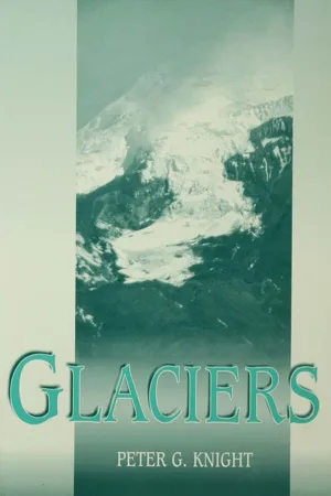
- 2 Glaciers and the Global System
2.1 Glaciers as Part of the Global Environment
When I explain to my final-year students the various skips and loops in their lecture programme, I like to say that reality is a bundle, not a list. The world is not organised as a linear narrative. No single element of the physical environment can be analysed comprehensively without reference to the system as a whole, and the physical environment as a whole cannot be understood without reference to its component parts. Therefore, although this book is about glaciers and not about the whole global environment, we need to begin by seeing glaciers as part of a broader environmental system. This chapter outlines some of the principal relationships between glaciers and other components of the environment. The aim is to provide a relatively simple environmental context for what follows in the rest of the book, and the references in the text should provide readers with a route into more specialised literature on the topics that are discussed.Glaciers affect, and are affected by, many elements of the global system, and play a central role in the operation of that system. Evidence from both present-day and former environments demonstrate the interaction of glaciation with climatic events at a range of time scales; with geological phenomena ranging from geomorphology and sedimentology to tectonics and volcanism; with the ocean/atmosphere circulation and the hydrological cycle; and with biotic activity. The periodic shift between glacial and non-glacial conditions in global history is one of the key controls on the planet's environment.As only about 0.1% of the world's population live in glaciated regions, there is a tendency for most of us to view glaciers and glaciation as something exotic or exceptional. We tend to see glaciers as external to our 'normal' conception of landscape; as isolated phenomena periodically imposed as an external force onto the landscape of an area. Those of us who live in presently non-glaciated areas think of glaciers as long ago or far away. However, glaciers play an integral role as parts of our landscape in a variety of different ways, and at a range of scales. This applies not only to locations where glaciers presently exist, but also to areas where they have existed in the past, and to areas well beyond the limits of contemporary glaciation. Glaciers affect both glaciated and non-glaciated areas at a global scale through their interaction with climate, sea-level, the hydrological cycle and the ocean/atmosphere circulation. We can also recognise the influence of glaciers that existed in the past on presently non-glaciated areas. Because glaciers in the past have been more extensive that at present, many modern glacier-free landscapes preserve a record of former glaciation in landforms, sediments and drainage patterns. Continuing postglacial isostatic rebound in many formerly glaciated areas, and the survival in the geological record of glacigenic sediments from the Precambrian period as much as about 2.5 x 10⁹ - eBook - PDF
Glacial Geology
An Introduction for Engineers and Earth Scientists
- N. Eyles(Author)
- 2013(Publication Date)
- Pergamon(Publisher)
(iii) A landsystem is a recurrent pattern of genetically linked land facets, suitable for mapping at scales of 1:250,000 to 1:1m. e.g. subglacial terrain where sediments and landforms of the landscape have been deposited at the base of an ice-sheet. An example would be a drumlin field flanked by an outwash plain and esker system. Each landsystem can be defined in terms of the sediment complexes underlying and at the same time controlling surface topography. The conditions at rockhead also vary from landsystem to landsystem. Although terrain evaluation is said to be concerned only with the uppermost few metres of the ground (Mitchell, 1973), the glacial landsystems which are considered here extend to bedrock regardless of depth. The basic premise of the approach followed in this book is that if the land system can be identified from surface landforms, then it is possible to identify in turn the relevant subsurface conditions. As such the approach has an important role in the initial desk-study phase of planning a variety of applied projects with the potential for saving time and hence money (Fig. 1.2). The landsystem, once identified, provides a model not only for planning and the interpretation of the results of site investigation and laboratory testing but focuses attention on those particular features that should be looked for in making a geological assessment of any location for a wide variety of purposes. 1.2 Glacial Landsystems A complex range and distribution of sediments result from glaciation. - eBook - PDF
- James Petersen, Dorothy Sack, Robert Gabler, , James Petersen, James Petersen, Dorothy Sack, Robert Gabler(Authors)
- 2021(Publication Date)
- Cengage Learning EMEA(Publisher)
539 19 LARGE MASSES OF FLOWING ICE, which are termed glaciers, play several important roles in the Earth system. They are excellent climate indicators because certain environmental conditions are required for glaciers to exist, and they respond visibly to climate variation. Glaciers become established, expand, contract, and disappear in response to changes in climate. Their long-term storage of freshwater as ice has a tremendous impact on the hydrologic cycle and the oceans, and the accumulation of ice by glaciers provides a record of past climates that can be studied in ice cores. Where glaciers once existed or where they were once much larger than they are today, much evidence can be found concerning past climatic conditions. The processes of erosion, transportation, and deposition by glaciers, whether ongoing or in the past, leave a distinctive stamp on a landscape. The term glaciation refers to the existence and actions of moving ice as well as its effects on the landscape. Some of the most beautiful and rugged terrain in the world exists in mountainous and other highland regions that have been sculpted by glaciers. Virtually every high-mountain region in the world displays glacial landscapes, including the Alps, the Rocky Mountains, the Himalayas, and the Andes. Glaciers have also carved impressive steep-sided coastal valleys in Norway, Chile, New Zealand, and Alaska. Rugged mountain peaks rising high above lake-filled valleys or narrow and deep oceanic embayments create the ultimate in scenic appeal for many people. Masses of moving ice have transformed the appearance of high mountains, as well as large portions of continental plains, into distinctive glacial landscapes. The flowing ice of glaciers is an effective and spectacular geomorphic agent on major portions of Earth’s surface. LEARNING OBJECTIVES WHEN YOU COMPLETE THIS CHAPTER YOU SHOULD BE ABLE TO: 19.1 Explain what a glacier is and how glacial ice forms. - No longer available |Learn more
- James Petersen, Dorothy Sack, Robert Gabler(Authors)
- 2016(Publication Date)
- Cengage Learning EMEA(Publisher)
The processes of erosion, transportation, and deposition by glaciers, whether ongoing or in the past, leave a distinctive stamp on a landscape. The term glaciation refers to the existence and actions of moving ice as well as its effects on the landscape. Some of the most beautiful and rugged terrain in the world exists in mountainous and other highland regions that have been sculpted by glaciers. Virtually every high-mountain region in the world displays glacial landscapes, OUTLINE Glacier Formation and the Hydrologic Cycle Types of Glaciers Geography’s Physical Science Perspective: Glacial Ice Is Blue! How Do Glaciers Flow? Glaciers as Geomorphic Agents Alpine Glaciers Equilibrium and the Glacial Budget Erosional Landforms of Alpine Glaciation Depositional Landforms of Alpine Glaciation Continental Glaciers Existing Continental Glaciers Thinking Geographically Pleistocene Glaciation Erosional Landforms of Continental Glaciation Geography’s Spatial Science Perspective: The Driftless Area—A Natural Region Depositional Landforms of Continental Glaciation Glacial Lakes Periglacial Landscapes Map Interpretation: Alpine Glaciation Map Interpretation: Continental Glaciation OBJECTIVES WHEN YOU COMPLETE THIS CHAPTER YOU SHOULD BE ABLE TO: ■ 19.1 Appreciate the role of glaciers in Earth’s hydrologic budget. ■ 19.2 Explain what a glacier is and how glacial ice forms. ■ 19.3 Differentiate between the different types of alpine and continental glaciers. ■ 19.4 Discuss the ways in which glaciers flow. ■ 19.5 Draw a cross section of an alpine glacier and identify its major surface and subsurface zones. ■ 19.6 Understand the processes of glacial erosion. ■ 19.7 Define each of the major glacial erosional landforms. ■ 19.8 Relate the principal characteristics of glacial sediments. ■ 19.9 Distinguish among the various glacial depositional landforms. ■ 19.10 Discuss what Earth’s glacial environment was like during the Pleistocene Epoch and how that environment influences people today. - eBook - PDF
Physical Geography
Great Systems and Global Environments
- William M. Marsh, Martin M. Kaufman(Authors)
- 2012(Publication Date)
- Cambridge University Press(Publisher)
And when we look back over the past two million years or so in Earth history, we find concrete evidence of distinct patterns of glaciers growing and shrinking in response to changes in climate. This is meaningful, but equally meaningful is the work of glaciers as geomorphic systems. They have enormous erosional power, so great that they are capable of grinding the sides off mountains. So we also want to learn how they form, grow, move, erode the land, transport rock debris, and shape landforms. We begin with the types of glaciers found in the world and how they originate and function as systems. Next, we look at glaciers as geomorphic agents, first mountain glaciers and then their larger counterparts, continental glaciers. In this connection we are interested in the occurrence of ice ages and their relationship to climate change on Earth. Chapter Overview 23 Glacial Systems: Growth, Motion, and Work of Glacial Ice Introduction We edged our way onto the ice shelf on Lake Superior’s south shore. It was January and a frigid wind bore down on us from the northwest. Along the front of the shelf, about 200 meters offshore, storm waves rammed against the ice sending spray and chunks of loose ice high into the air. As it fell onto the shelf, the spray froze immediately in a slick glaze. With each storm the glaze and ice chunks built up along the shelf front eventually giving rise to a distinct ridge, like the one in Figure 23.1, reaching 6 or 7 meters high in places. Weighted down by this frozen superstructure, the shelf, like an overloaded ship, settled deeper into the lake until it rested firmly on the bottom. We came to this forbidding place to study ice. On first glance, it seemed like an easy assignment, for ice was everywhere around us. But the glaze formed such a thick skin over the shelf that there was no easy way to examine its inner features. Len Bryan offered a proposal, “Why not dissect one the of the ice ridges so we can inspect its inner structure and - eBook - ePub
- Barry G. Clarke(Author)
- 2017(Publication Date)
- CRC Press(Publisher)
The development of glacial land systems can be traced back to Boulton and Paul (1976), Boulton and Eyles (1979) and Eyles (1983). Sequences of glacial deposits are bounded by unconformable boundaries not too dissimilar to hydrocarbon reservoirs. The connection is the use of sequence stratigraphy developed by petroleum geologists for locating such reservoirs. Sequence stratigraphy has been applied to glacial deposition by Boulton (1990), Eyles and Eyles (1992), Martini and Brookfield (1995), Benn and Evans (2010), Evans (2014) and others. The glacial land systems of the United Kingdom are shown in Figure 2.31 using the terrain to highlight likely glacial deposits. The large-scale distribution of depositional systems and land systems can be subglacial, ice marginal and supraglacial, subaqueous and glaciated valleys (Benn and Evans, 2010). A summary of glacial land systems is given in Table 2.13, which links the erosional landform with sediments. Figure 2.31 Glacial land systems in the United Kingdom. (After Eyles, N. and W. R. Dearman. Bulletin of the International Association of Engineering Geology – Bulletin de l’Association Internationale de Géologie de l’Ingénieur, 24(1); 1981: 173–184.) Table 2.13 Glacial erosional landforms and the underlying sediments 2.5 Glacial dynamics Engineering properties of glacial soils depend on their source, methods of erosion, transportation, deposition and deformation, in the case of glacial tills, subsequent pro-glacial processes. Classic soil mechanics is based on an assumption that fine and coarse grained soils are gravitationally consolided and the fine-grained soils are composed of clay minerals. Most glacial soils are composite soils, the fine-grained content may be rock flour and primary deposits are not gravitationally consolidated - eBook - PDF
Geomorphology: The Research Frontier and Beyond
Proceedings of the 24th Binghamton Symposium in Geomorphology, August 25, 1993
- J.D. Vitek, J.R. Giardino(Authors)
- 2013(Publication Date)
- Elsevier Science(Publisher)
In a recent paper, Thorn (1992) tries to avoid these uncertainties, defines periglacial geomorphology as follows (Thorn, 1992, pp. 1,24): Periglacial geomorphology is that part of geomorphol-ogy which has as its primary object physically based ex-planations of the past, present, and future impacts of diurnal, seasonal, and perennial ground ice on landform initiation and development. Additional components of the subdiscipline include similar investigations of the geo-morphic roles of snowpacks (but not glaciers) and flu-vial, lacustrine, and marine ice. This is a very interesting, challenging, but also a very restricted definition. Seasonal or perennial ground ice (including perennial snow fields, fluvial, lacustrine and marine ice) forms an extremely important part in all periglacial geosystems, but not the only one. Ground ice in its perennial form (permafrost) is diagnos-tic, but not decisive for periglacial environ-ments (cf. the discussion by Washburn, 1979, pp. 1-4). Ground ice in a seasonal form exists also outside the polar regions. Are, therefore, some of the extreme winter cold areas with in-tense seasonal ground freezing in Armenia or eastern Turkey periglacial regions if the sea-sonal ground ice has an impact on landform initiation (e.g. soil erosion due to structural weakening by frost)? How long must the ground ice exist? How thick must it be? This definition tries to establish periglacial geomorphology on the same general level as fluvial, glacial or eolian geomorphology, which discuss special geomorphic agents. Regarding the above cited areal concept in periglacial geomorphology, this approach is very ques-tionable. The periglacial realm comprises the polar regions as long as they are not covered by glaciers. For definition of a boundary towards lower latitudes, the forest line can be used, even if permafrost exists in the subpolar or boreal forests. - eBook - PDF
- David Huddart, Tim A. Stott(Authors)
- 2019(Publication Date)
- Wiley-Blackwell(Publisher)
Evans (2003) provides further detailed land system tem- plates for glacial depositional environments and glaciated terrain. In this section, we focus on six land systems, before considering the variables that control their distribution within a range of different ice sheets. The land systems are: ● Preservational , cold − based continental ice sheets ● Warm − based continental ice sheets ● Glaciomarine ● Valley ● Surging glacier ● Glaciovolcanic. 20.6.1 Preservational, Cold‐Based Continental Ice Sheets Glaciers modify the landscapes over which they move and tend to preserve that date from either earlier periods of glaciation, or interglacial, or pre‐ glacial times. There are several ways in which this preservation can occur. First, at the centre of large Ice retreat Glaciation Ice advance Marine muds Till Diamiction Muds woith dropstones and ‘rain-out’ diamiction Marine muds Mud Sand Diamicton Distal glaciomarine: fine muds,, decreasing number of dropstones Lodgement or deformation till Grounding-line fan Marine muds Distal glaciomarine: fine muds, decreasing number of dropstones Proximal glaciomarine: ice -rafted diamictons and mud from suspension. diamicton deposited by sediment gravity flows Proximal glaciomarine: ice-rafted diamictons and mud from suspension units of diamiction formed by sediment gravity flows Figure 20.42 Hypothetical log deposited on the continental shelf during a single glacial cycle in which a grounded glacier advances and decays across a continental shelf. Source: After Bennett and Glasser (1996). 20.6 Glacial Landsystems 575 continental ice sheets ice velocities are very low or negligible. This is due to the fact that ice flows away from ice divides, or centres of mass, towards the margin and because ice velocity accelerates from the divide to a maximum below the equilib- rium line. Consequently, bed modification may be minor beneath the ice divide. Second, continental‐ scale ice sheets tend to have interiors that are frozen to their beds. - eBook - PDF
Physical Geology
The Science of Earth
- Charles Fletcher(Author)
- 2017(Publication Date)
- Wiley(Publisher)
Earth’s recent history has been char- acterized by cool climate periods called ice ages, during which glaciers around the world expanded, and warm periods called interglacials, during which glaciers retreated. By studying the history of climate changes, scientists learn how natural sys- tems respond to shifts in temperature and ice volume. Today, most of the world’s ice sheets, alpine glaciers, ice shelves, and sea ice are shrinking in reaction to global warming. LO 15.1 Describe glaciers and where they occur today. Glaciers are found in most of the worlds highest moun- tain systems and on polar lands. In the past, when climate has been cooler and warmer, glaciers have expanded and contracted. A Glacier Is a River of Ice 461 Glaciers are made of compressed, recrystallized snow, and usually transport a large load of sediments; they range in length and width from several hundred meters to hundreds of kilometers. Most glaciers are several thousand years old, though the glaciers covering Antarctica have been in existence in one form or another for hundreds of thousands of years. Glaciers develop on land at high elevations (moun- tains) and high latitudes (the Arctic and Antarctic) above the snowline, the elevation above which snow tends to accumulate from one year to the next rather than com- pletely melt during the summer. Even mountains in the tropics, such as the Andes of Peru, have a snowline; likewise, mountainous regions in equatorial New Guinea and Africa have glaciers. Snowlines occur at lower elevations in temperate and Arctic regions than in the tropics. In fact, the farther one travels from the equator, the lower the snowline, until reaching the High Arctic, where the ground at sea level is permanently frozen in what is known as permafrost (Figure 15.2). Permafrost is soil whose temperature remains at or below the freezing point of water for more than two years. - eBook - PDF
- Timothy Foresman, Alan H. Strahler(Authors)
- 2012(Publication Date)
- Wiley(Publisher)
Explain whataniceageis. 2. Explain thepossiblecausesofglaciationcycles. 3. Describe thepredictedeffectofclimatechange onglaciation. G lacial ice sheets have a significant impact on our global climate. Because glacial ice sheets reflect much of the solar radiation they receive, they influence the Earth’s radiation and heat balance. The temperature difference between ice sheets and warm regions near the equator helps drive the system of global heat transport. When the volume of glacial ice in- creases, as it does during a glaciation, sea levels fall. When the ice sheets melt away, sea level rises. Today’s coastal en- vironments evolved during a rising sea level accompanying the melting of the last ice sheets of the Ice Age. History of Glaciation Glaciation occurs when temperatures fall in regions of ample snowfall, allowing ice to accumulate and build. De- glaciation occurs when the ice melts at the beginning of a period of milder climate called an interglaciation. An ice age is a period of millions of years of generally cold cli- mate consisting of many alternating glaciations and in- terglaciations. Throughout its long history, the Earth has cycled through a number of ice ages. The Ice Age The Cenozoic Era, which began about 66 million years ago, has seen a gradually cooling climate, culminating in the recent Ice Age. By about 40 million years ago, the Antarctic Ice Sheet began to form, and by about 5 million years ago, the Arctic Ocean was ice cov- ered. Throughout the past 2.5 million years or so, the Earth has been experiencing the Late-Cenozoic Ice Age (or, simply, the Ice Age). This ice age consists of alternat- ing glacial and interglacial periods; five major glaciations have occurred in the past 500,000 years. Scientists have established a record of climate cycles during this period by analyzing layers of sediment deep under the sea.
Index pages curate the most relevant extracts from our library of academic textbooks. They’ve been created using an in-house natural language model (NLM), each adding context and meaning to key research topics.
