
German Coastal Radar Stations
Then and Now
Winston Ramsey, Jean Paul Pallud
- 192 pagine
- English
- ePUB (disponibile sull'app)
- Disponibile su iOS e Android
German Coastal Radar Stations
Then and Now
Winston Ramsey, Jean Paul Pallud
Informazioni sul libro
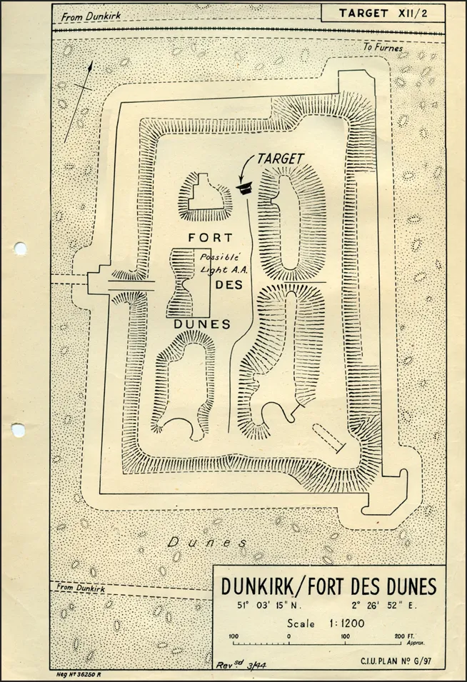
When German forces occupied the coastline of the English Channel in 1940, one of the measures undertaken to give early warning of attacks from the sea or air was to set up a line of radar stations. Although this invisible screen was a passive defense, it was a serious 'barrier' that had to be neutralized for the Allied invasion to be launched in 1944. Planners at RAF Medmenham had established there the Central Interpretation Unit (CIU) to examine the results of aerial photography over the Continent and the unit prepared plans of every enemy radar site ready for briefing pilots undertaking pre-invasion attacks. Those once-secret plans are now reproduced in this book, alongside the wartime photography, with comparison views of the sites today. Where farmland has now reclaimed the sites little remains to be seen, but on others there are still significant traces of a once-powerful weapon in the German armory. To set the scene, Professor R. V. Jones, the Assistant Director of Intelligence at the Air Ministry, recounts the events leading up to the proposal to mount a raid on the radar site at Bruneval. The site had what became known as a 'Würzburg' and the idea was to dismantle and remove the critical parts of the unit to bring then back to Britain and, hopefully, at the same time capture the operators for interrogation.
Domande frequenti
Informazioni
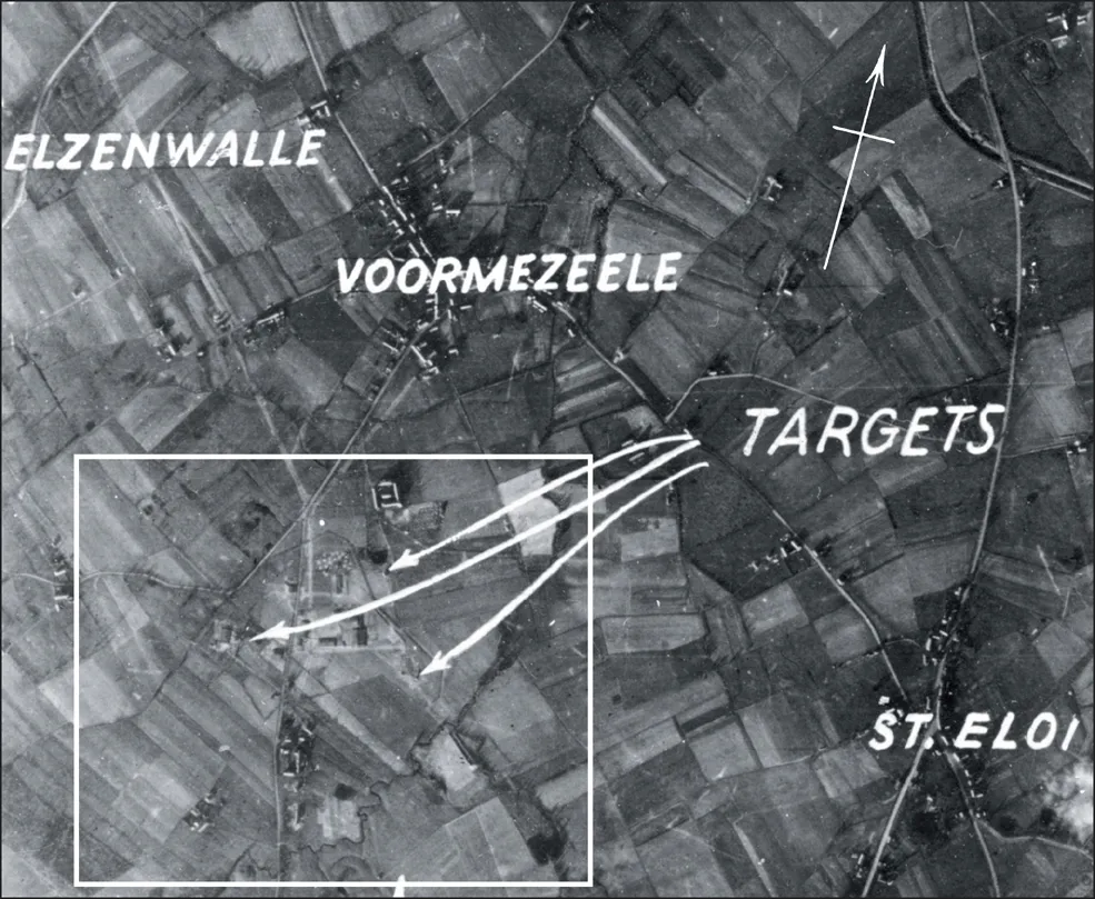
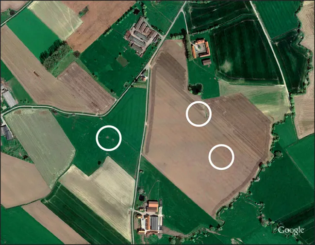
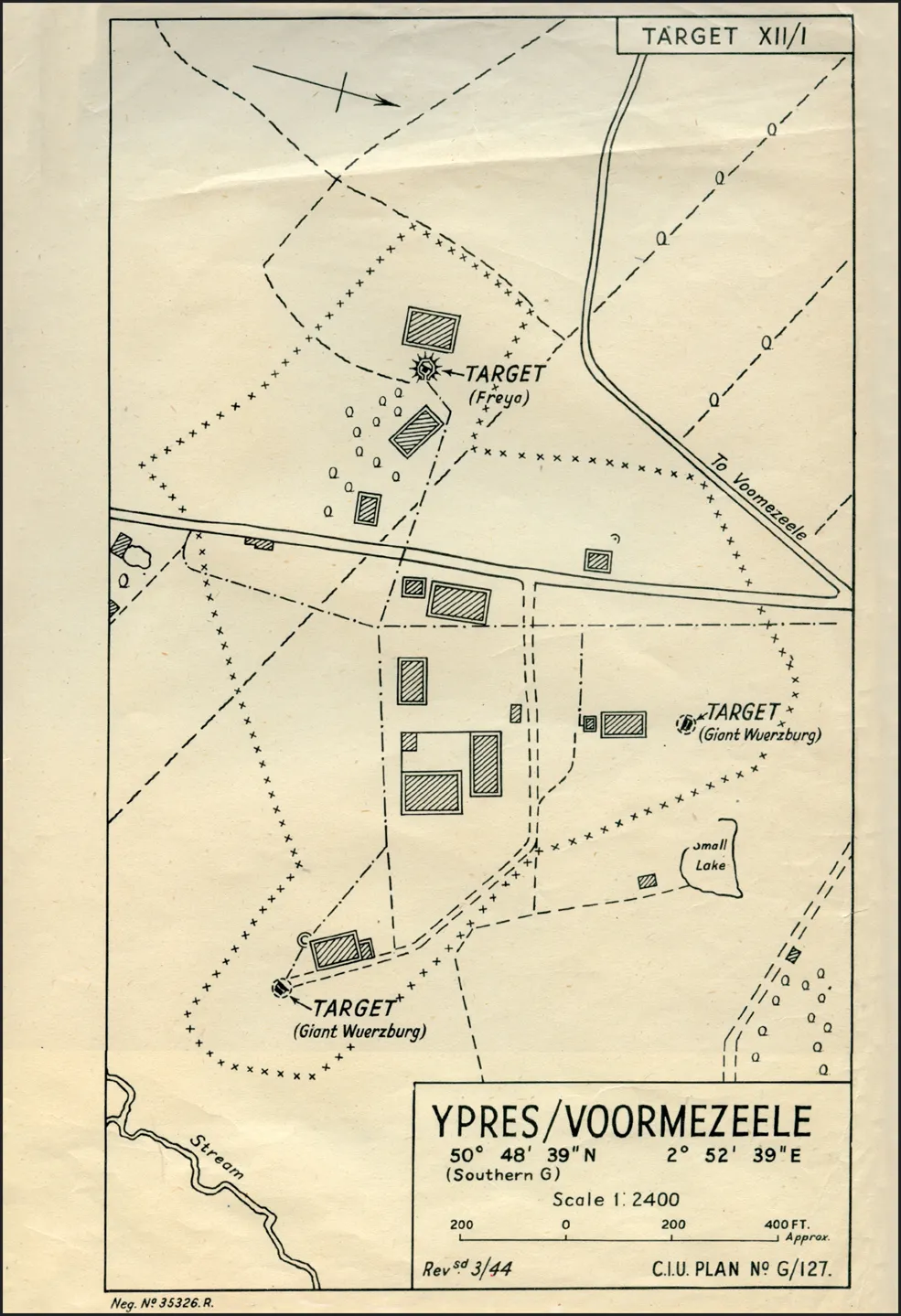
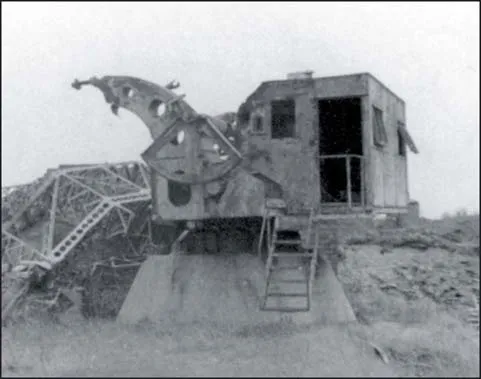
YPRES/VOORMEZEELE
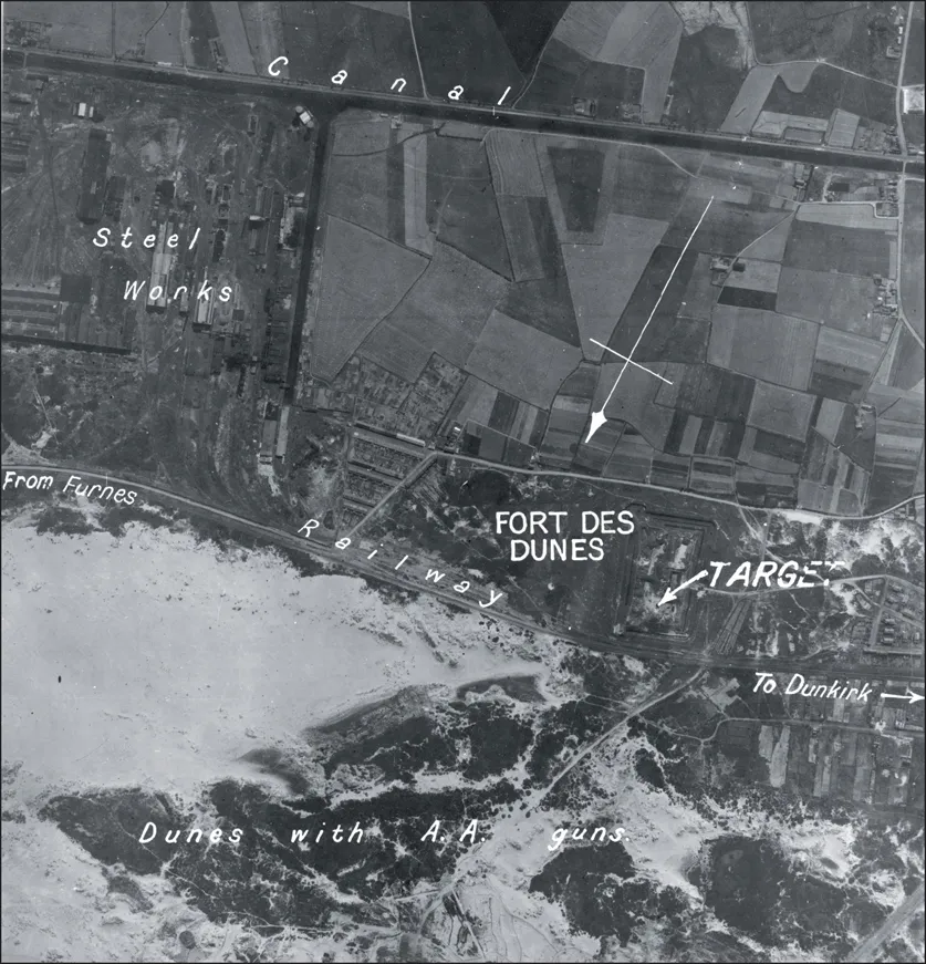
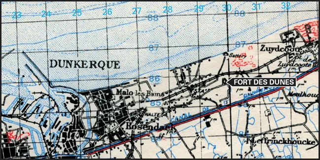
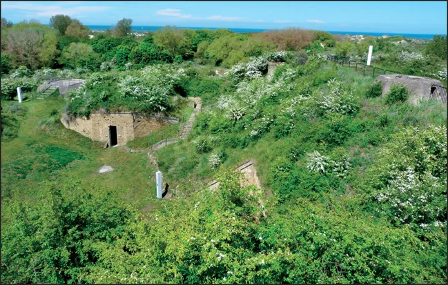
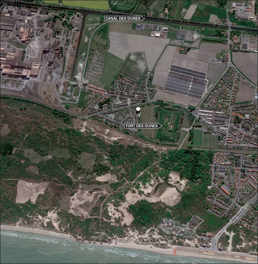
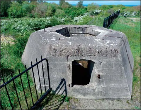
DUNKIRK/FORT DES DUNES
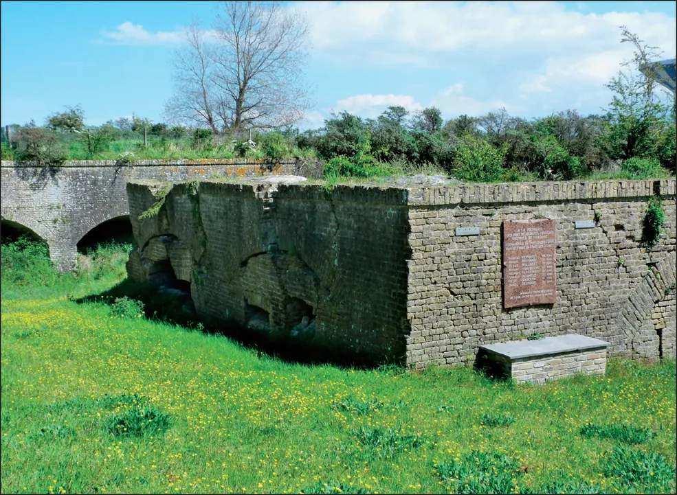
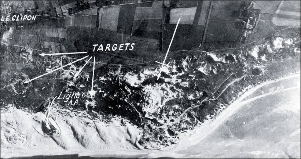
GRAVELINES/LE CLIPON
Indice dei contenuti
- Cover
- Title
- Credits
- Acknowledgements
- Editorial Note
- Contents
- Introduction — BRUCE ROBERTSON
- The Bruneval Raid— ALFRED PRICE
- Operations Against Coastal Radar Stations — R. V. JONES
- Ypres/Voormezele (Target No. 1)
- Dunkirk/Fort des Dunes (Target No. 2)
- Gravelines/Le Clipon (Target No. 3)
- Gravelines/Petit-Fort-Philippe (Target No. 4)
- Cap Blanc-Nez (Target No. 5)
- Cap Blanc-Nez/St Pol (Target No. 6)
- Cap Gris-Nez (Target No. 7)
- Cap Gris-Nez/Pointe du Riden (Target No. 8)
- Cap Gris-Nez/Bellevue (Target No. 9)
- Cap Gris-Nez/Wattermel St George (Target No. 10)
- Cap Gris-Nez/Onglevert (Target No. 11)
- Boulogne/Boursin (Target No. 12)
- Boulogne/Monument (Target No. 13)
- Boulogne/Mont Lambert (Target No. 14)
- Boulogne/Cap d’Alprech (Target No. 15A)
- Boulogne/Cap d’Alprech (Target No. 15B)
- Boulogne/Hardelot (Target No. 16)
- Mont Violette (Target No. 17)
- Neufchâtel/Mont St Frieux (Target No. 18)
- Le Touquet/Plage Ste Cécile (Target No. 19)
- Fruges/Prédefin (Target No. 20)
- Aubigny/Frévillers (Target No. 21)
- Berck-sur-Mer (Target No. 22)
- Cayeux/Nouveau Brighton (Target No. 23)
- Amiens/Montrelet (Target No. 24)
- Abbeville/Vaudricourt (Target No. 25)
- Le Tréport/Mont Huon (Target No. 26)
- 101 Dieppe/Caude-Côte (Target No. 27)
- St Valéry-en-Caux/Manneville-ès-Plains (Target No. 28)
- St Valéry-en-Caux/St Martin-aux-Buneaux (Target No. 29)
- Fécamp/Chapelle de la Vierge (Target No. 30)
- Cap d’Antifer/Sémaphore (Target No. 31)
- Cap d’Antifer (Target No. 32)
- Yvetot/Épinay-sur-Duclair (Target No. 33)
- Neufchâtel/Sully (Target No. 34)
- Le Havre/Cap de la Hève (Target No. 35)
- Lisieux/Le Theil-Nolent (Target No. 36)
- Bernay/La Chalière (Target No. 37)
- Houlgate/Sémaphore (Target No. 38)
- Caen/Douvres-la-Délivrande (Target No. 39)
- Arromanches (Target No. 40)
- Pointe et Raz de la Percée (Target No. 41)
- St Lô/Bourg d’Enfer (Target No. 42)
- Vire/Le Parc (Target No. 43)
- Barfleur/Le Vicel (Target No. 44)
- Cherbourg/Cap Lévy (Target No. 45)
- Cherbourg/Fermanville (La Brasserie) (Target No. 46)
- Omonville la Rogue/Asselins (Target No. 47)
- Cap de la Hague/Auderville (Target No. 48)
- Cap de la Hague/Jobourg (Target No. 49)
- Cap de Carteret/Sémaphore (Target No. 50)
- Guernsey/Fort George (Target No. 51)
- Guernsey/Pleinemont (Target No. 52)
- Jersey/Rouge Nez (Target No. 53)
- St Malo/Pointe du Grouin (Target No. 54)
- Cap Fréhel/Sémaphore (Target No. 55)
- Moncontour/Bel-Air (Target No. 56)
- Loudéac/La Récompense (Target No. 57)
- Monterfil/Les Épinais (Target No. 58)
- Vitré/La Haye (Target No. 59)
- Oisseau/Marêtre (Target No. 60)
- Falaise/Ri (Target No. 61)
- Dieppe/Ste Marguerite (Target No. 62)
- St Valéry-en-Caux/St Léger (Target No. 63)
- Bayeux/Le Mesnil (Target No. 64)
- Calais/Sangatte (Target No. 65)
- Postscript