Ptolemy's Geography is the only book on cartography to have survived from the classical period and one of the most influential scientific works of all time. Written in the second century AD, for more than fifteen centuries it was the most detailed topography of Europe and Asia available and the best reference on how to gather data and draw maps. Ptolemy championed the use of astronomical observation and applied mathematics in determining geographical locations. But more importantly, he introduced the practice of writing down coordinates of latitude and longitude for every feature drawn on a world map, so that someone else possessing only the text of the Geography could reproduce Ptolemy's map at any time, in whole or in part, at any scale.
Here Berggren and Jones render an exemplary translation of the Geography and provide a thorough introduction, which treats the historical and technical background of Ptolemy's work, the contents of the Geography, and the later history of the work.
eBook - ePub
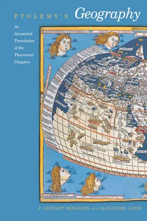
Ptolemy's Geography
An Annotated Translation of the Theoretical Chapters
- English
- ePUB (mobile friendly)
- Available on iOS & Android
eBook - ePub
Ptolemy's Geography
An Annotated Translation of the Theoretical Chapters
About this book
Trusted by 375,005 students
Access to over 1.5 million titles for a fair monthly price.
Study more efficiently using our study tools.
Information
Publisher
Princeton University PressYear
2020Print ISBN
9780691092591
9780691010427
eBook ISBN
9780691214115
PTOLEMY
Guide to Drawing a Map of the World
Book 1
1. On the difference between world cartography and regional cartography
World cartography1 is an imitation through drawing of the entire known part of the world together with the things that are, broadly speaking, connected with it. It differs from regional cartography in that regional cartography, as an independent discipline, sets out the individual localities, each one independently and by itself, registering practically everything down to the least thing therein (for example, harbors, towns, districts, branches of principal rivers, and so on), while the essence of world cartography is to show the known world as a single and continuous entity, its nature and how it is situated, [taking account] only of the things that are associated with it in its broader, general outlines (such as gulfs, great cities, the more notable peoples and rivers, and the more noteworthy things of each kind).
The goal of regional cartography is an impression of a part, as when one makes an image of just an ear or an eye; but [the goal] of world cartography is a general view, analogous to making a portrait of the whole head. That is, whenever a portrait is to be made, one has to fit in the main parts [of the body] in a determined pattern and an order of priority. Furthermore the [surfaces] that are going to hold the drawings ought to be of a suitable size for the spacing of the visual rays2 at an appropriate distance [from the spectator], whether the drawing be of whole or part, so that everything will be grasped by the sense [of sight].
In the same way, reason and convenience would both seem to dictate that it should be the task of regional cartography to present together even the most minute features, while world cartography [should present] the countries themselves along with their grosser features. This is because with respect to the oikoumenē3 it is the geographical placements of countries that are the main parts, [namely] the ones that are well placed and of suitable sizes [for a map], whereas the various things contained in these [countries have the same relationship] with respect to [the countries themselves].
Regional cartography deals above all with the qualities rather than the quantities of the things that it sets down; it attends everywhere to likeness, and not so much to proportional placements.4 World cartography, on the other hand, [deals] with the quantities more than the qualities, since it gives consideration to the proportionality of distances for all things, but to likeness only as far as the coarser outlines [of the features], and only with respect to mere shape. Consequently, regional cartography requires landscape drawing, and no one but a man skilled in drawing would do regional cartography. But world cartography does not [require this] at all, since it enables one to show the positions and general configurations [of features] purely by means of lines and labels.
For these reasons, [regional cartography] has no need of mathematical5 method, but here [in world cartography] this element takes absolute precedence. Thus the first thing that one has to investigate is the earth’s shape, size, and position with respect to its surroundings [i.e., the heavens], so that it will be possible to speak of its known part, how large it is and what it is like, and moreover [so that it will be possible to specify] under which parallels of the celestial sphere each of the localities in this [known part] lies. From this last, one can also determine the lengths of nights and days, which stars reach the zenith or are always borne above or below the horizon,6 and all the things that we associate with the subject of habitations.7
These things belong to the loftiest and loveliest of intellectual pursuits, namely to exhibit to human understanding through mathematics [both] the heavens themselves in their physical nature (since they can be seen in their revolution about us), and [the nature of] the earth through a portrait (since the real [earth], being enormous and not surrounding us, cannot be inspected by any one person either as a whole or part by part).8
2. On the prerequisites for world cartography
We shall let this serve as a brief sketch of the purpose of anyone who would be a world cartographer, and how he differs from the regional cartographer. Our present object is to map our oikoumenē as far as possible in proportionality with the real [oikoumenē]. But at the outset we think it is necessary to state clearly that the first step in a proceeding of this kind is systematic research, assembling the maximum of knowledge from the reports of people with scientific training who have toured the individual countries; and that the inquiry and reporting is partly a matter of surveying, and partly of astronomical observation. The surveying component is that which indicates the relative positions of localities solely through measurement of distances; the astronomical component [is that which does the same] by means of the phenomena [obtained] from astronomical sighting and shadow-casting instruments.9 Astronomical observation is a self-sufficient thing and less subject to error, while surveying is cruder and incomplete without [astronomical observation].
For, in the first place, in either procedure one has to assume as known the absolute direction of the interval between the two localities in question, since it is necessary to know not merely how far this [place] is from that, but also in which direction, that is, to the north, say, or to the east, or more refined directions than these. But one cannot find this out accurately without observation by means of the aforesaid instruments, from which the direction of the meridian line [with respect to one’s horizon], and thereby [the absolute directions] of the traversed intervals, are easily demonstrated at any place and time.
In the next place, even when this [direction] has been given, having a measurement of distance in stades does not guarantee that the [interval] we find is the correct one, because one seldom encounters rectilinear journeys on account of the numerous diversions that are involved in both land and sea travel. For land journeys one has to estimate the surplus [in the reported distance] corresponding to the kind and magnitude of the diversions and subtract this from the total of stades to find the [number of stades] of the rectilinear [route]. For sea journeys one also has to account for the variation in speed...
Table of contents
- Cover Page
- Title Page
- Copyright Page
- Dedication
- Contents
- List of Illustrations
- Preface
- Note on Citations of Classical Authors
- Introduction
- Ptolemy, Guide to Drawing a Map of the World
- Plates and Maps
- Appendices
- Bibliography
- Index
Frequently asked questions
Yes, you can cancel anytime from the Subscription tab in your account settings on the Perlego website. Your subscription will stay active until the end of your current billing period. Learn how to cancel your subscription
No, books cannot be downloaded as external files, such as PDFs, for use outside of Perlego. However, you can download books within the Perlego app for offline reading on mobile or tablet. Learn how to download books offline
Perlego offers two plans: Essential and Complete
- Essential is ideal for learners and professionals who enjoy exploring a wide range of subjects. Access the Essential Library with 800,000+ trusted titles and best-sellers across business, personal growth, and the humanities. Includes unlimited reading time and Standard Read Aloud voice.
- Complete: Perfect for advanced learners and researchers needing full, unrestricted access. Unlock 1.5M+ books across hundreds of subjects, including academic and specialized titles. The Complete Plan also includes advanced features like Premium Read Aloud and Research Assistant.
We are an online textbook subscription service, where you can get access to an entire online library for less than the price of a single book per month. With over 1.5 million books across 990+ topics, we’ve got you covered! Learn about our mission
Look out for the read-aloud symbol on your next book to see if you can listen to it. The read-aloud tool reads text aloud for you, highlighting the text as it is being read. You can pause it, speed it up and slow it down. Learn more about Read Aloud
Yes! You can use the Perlego app on both iOS and Android devices to read anytime, anywhere — even offline. Perfect for commutes or when you’re on the go.
Please note we cannot support devices running on iOS 13 and Android 7 or earlier. Learn more about using the app
Please note we cannot support devices running on iOS 13 and Android 7 or earlier. Learn more about using the app
Yes, you can access Ptolemy's Geography by Ptolemy, J. Lennart Berggren, Alexander Jones, J. Lennart Berggren,Alexander Jones in PDF and/or ePUB format, as well as other popular books in History & Science History. We have over 1.5 million books available in our catalogue for you to explore.