Spatial Thinking in Environmental Contexts
Maps, Archives, and Timelines
- 224 pages
- English
- ePUB (mobile friendly)
- Available on iOS & Android
Spatial Thinking in Environmental Contexts
Maps, Archives, and Timelines
About this book
Spatial Thinking in Environmental Contexts: Maps, Archives, and Timelines cultivates the spatial thinking "habit of mind" as a critical geographical view of how the world works, including how environmental systems function, and how we can approach and solve environmental problems using maps, archives, and timelines. The work explains why spatial thinking matters as it helps readers to integrate a variety of methods to describe and analyze spatial/temporal events and phenomena in disparate environmental contexts. It weaves together maps, GIS, timelines, and storytelling as important strategies in examining concepts and procedures in analyzing real-world data and relationships. The work thus adds significant value to qualitative and quantitative research in environmental (and related) sciences.
Features
- Written by internationally renowned experts known for taking complex ideas and finding accessible ways to more broadly understand and communicate them.
- Includes real-world studies explaining the merging of disparate data in a sensible manner, understandable across several disciplines.
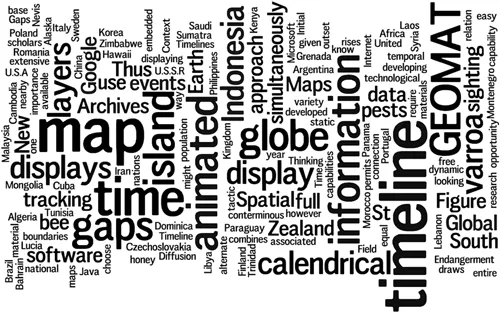
- Unique approach to spatial thinking involving animated maps, 3D maps, GEOMATs, and story maps to integrate maps, archives, and timelines—first across a single environmental example and then through varied examples.
- Merges spatial and temporal views on a broad range of environmental issues from traditional environmental topics to more unusual ones involving urban studies, medicine, municipal/governmental application, and citizen-scientist topics.
- Provides easy to follow step-by-step instructions to complete tasks; no prior experience in data processing is needed.
Tools to learn more effectively

Saving Books

Keyword Search

Annotating Text

Listen to it instead
Information
IV
GEOMATs, 2000s
12
Varroa GEOMAT: Honeybee Mite
Sandra L. Arlinghaus and Diana Sammataro
Compression of Information Using GEOMAT
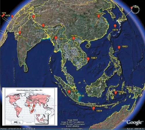
| 1904 | Initial recorded sighting of Varroa on the island of Java, Indonesia. |
| 1905 | No new sightings recorded. |
| 1906 | No new sightings recorded. |
| 1907 | No new sightings recorded. |
| 1908 | No new sightings recorded. |
| 1909 | No new sightings recorded. |
| 1910 | No new sightings recorded. |
| 1911 | No new sightings recorded. |
| 1912 | Next recorded sighting, on nearby Sumatra island, Indonesia. |
| 1913 | No new sightings recorded. |
| 1914 | No new sightings recorded. |
| 1915 | No new sightings recorded. |
| 1916 | No new sightings recorded. |
| 1917 | No new sightings recorded. |
| 1918 | No new sightings recorded. |
| 1919 | No new sightings recor... |
Table of contents
- Cover
- Half-Title
- Title
- Copyright
- Contents
- Preface
- Acknowledgments
- Editors, Co-Editors, and Principal Contributors
- Contributors
- SECTION I Introductory Matter
- SECTION II Animaps, 1990s
- SECTION III 3D Maps: Georeferencing, Turn of the Millennium
- SECTION IV GEOMATs, 2000s
- SECTION V Story Maps, 2010s
- 21 In Closing: Spatial Thinking, from Evolution to Revolution
- Index
Frequently asked questions
- Essential is ideal for learners and professionals who enjoy exploring a wide range of subjects. Access the Essential Library with 800,000+ trusted titles and best-sellers across business, personal growth, and the humanities. Includes unlimited reading time and Standard Read Aloud voice.
- Complete: Perfect for advanced learners and researchers needing full, unrestricted access. Unlock 1.4M+ books across hundreds of subjects, including academic and specialized titles. The Complete Plan also includes advanced features like Premium Read Aloud and Research Assistant.
Please note we cannot support devices running on iOS 13 and Android 7 or earlier. Learn more about using the app