- 397 pages
- English
- PDF
- Available on iOS & Android
eBook - PDF
Geoinformatics in Applied Geomorphology
About this book
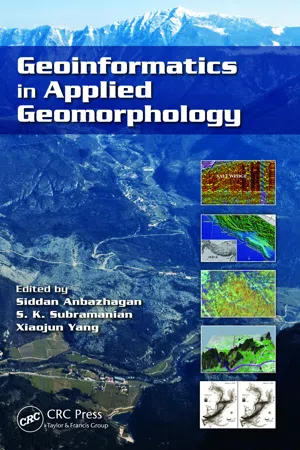
With recent innovations in the arena of remote sensing and geographic information systems, the use of geoinformatics in applied geomorphology is receiving more attention than ever. Geoinformatics in Applied Geomorphology examines how modern concepts, technologies, and methods in geoinformatics can be used to solve a wide variety of applied geomorph
Tools to learn more effectively

Saving Books

Keyword Search

Annotating Text

Listen to it instead
Information
Table of contents
- Front Cover
- Contents
- Preface
- Editors
- Contributors
- Chapter 1: Geoinformatics: An Overview and Recent Trends
- Chapter 2: Airborne Laser Scanning and Very High-Resolution Satellite Data for Geomorphological Mapping in Parts of Elbe River Valley, Germany
- Chapter 3: Geoinformatics in Spatial and Temporal Analyses of Wind Erosion in Thar Desert
- Chapter 4: Remote Sensing and GIS for Coastal Zone Management: Indian Experience
- Chapter 5: Kuwait Coastline Evolution during 1989–2007
- Chapter 6: Detecting Estuarine Bathymetric Changes with Historical Nautical Data and GIS
- Chapter 7: High-Resolution Mapping, Modeling, and Evolution of Subsurface Geomorphology Using Ground-Penetrating Radar Techniques
- Chapter 8: Remote Sensing in Tectonic Geomorphic Studies: Selected Illustrations from the Northwestern Frontal Himalaya, India
- Chapter 9: Strain Accumulation Studies between Antarctica and India by Geodetically Tying the Two Continents with GPS Measurements
- Chapter 10: Indian Ocean Basin Deformation Studies by Episodic GPS Campaigns in the Islands Surrounding India
- Chapter 11: Remote Sensing and GIS in Groundwater Evaluation in Hilly Terrain of Jammu and Kashmir
- Chapter 12: Remote Sensing in Delineating Deep Fractured Aquifer Zones
- Chapter 13: Remote Sensing and GIS for Locating Artificial Recharge Structures for Groundwater Sustainability
- Chapter 14: Fuzzy Arithmetic Approach to Characterize Aquifer Vulnerability Considering Geologic Variability and Decision Makers’ Imprecision
- Chapter 15: Remote Sensing and GIS in Petroleum Exploration
- Chapter 16: Geoinformatics in Terrain Analysis and Landslide Susceptibility Mapping in Part of Western Ghats, India
- Chapter 17: Impact of Tsunami on Coastal Morphological Changes in Nagapattinam Coast, India
- Chapter 18: Remote Sensing for Glacier Morphological and Mass Balance Studies
- Chapter 19: Geomorphology and Development Mechanism of Sinkholes in Arid Regions with Emphasis on West Texas, Qatar Peninsula, and Dead Sea Area
- Back Cover
Frequently asked questions
Yes, you can cancel anytime from the Subscription tab in your account settings on the Perlego website. Your subscription will stay active until the end of your current billing period. Learn how to cancel your subscription
No, books cannot be downloaded as external files, such as PDFs, for use outside of Perlego. However, you can download books within the Perlego app for offline reading on mobile or tablet. Learn how to download books offline
Perlego offers two plans: Essential and Complete
- Essential is ideal for learners and professionals who enjoy exploring a wide range of subjects. Access the Essential Library with 800,000+ trusted titles and best-sellers across business, personal growth, and the humanities. Includes unlimited reading time and Standard Read Aloud voice.
- Complete: Perfect for advanced learners and researchers needing full, unrestricted access. Unlock 1.4M+ books across hundreds of subjects, including academic and specialized titles. The Complete Plan also includes advanced features like Premium Read Aloud and Research Assistant.
We are an online textbook subscription service, where you can get access to an entire online library for less than the price of a single book per month. With over 1 million books across 990+ topics, we’ve got you covered! Learn about our mission
Look out for the read-aloud symbol on your next book to see if you can listen to it. The read-aloud tool reads text aloud for you, highlighting the text as it is being read. You can pause it, speed it up and slow it down. Learn more about Read Aloud
Yes! You can use the Perlego app on both iOS and Android devices to read anytime, anywhere — even offline. Perfect for commutes or when you’re on the go.
Please note we cannot support devices running on iOS 13 and Android 7 or earlier. Learn more about using the app
Please note we cannot support devices running on iOS 13 and Android 7 or earlier. Learn more about using the app
Yes, you can access Geoinformatics in Applied Geomorphology by Siddan Anbazhagan, S.K. Subramanian, XIAOJUN YANG in PDF and/or ePUB format, as well as other popular books in Physical Sciences & Geology & Earth Sciences. We have over one million books available in our catalogue for you to explore.