- English
- ePUB (mobile friendly)
- Available on iOS & Android
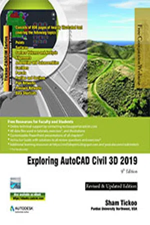
Exploring AutoCAD Civil 3D 2019, 9th Edition
About This Book
Exploring AutoCAD Civil 3D 2019 textbook introduces the users to the powerful Building Information Modeling (BIM) solution, AutoCAD Civil 3D. The BIM solution in AutoCAD Civil 3D helps create and visualize a coordinated data model. This data model can then be used to design and analyze a civil engineering project for its optimum and cost-effective performance. This textbook has been written considering the needs of the professionals such as engineers, surveyors, watershed and storm water analysts, land developers and CAD technicians, who wish to learn and explore the usage and abilities of AutoCAD Civil 3D in their respective domains. This textbook provides comprehensive text and graphical representation to explain various concepts and procedures required in designing solutions for various infrastructure works. The accompanying tutorials and exercises, which relate to the real world projects, help you better understand the tools in AutoCAD Civil 3D.This textbook consists of 13 chapters covering Points Creations, Surface Creations, Surface Analysis, Corridor Modeling, Pipe Networks, Pressure Networks, and Parcels and so on. The chapters are organized in a pedagogical sequence to help users understand the concepts easily. Each chapter begins with a command section that provides a detailed explanation of the commands and tools in AutoCAD Civil 3D. The chapters in this textbook cover the basic as well as advanced concepts in AutoCAD Civil 3D such as COGO points, surfaces and surface analysis, alignments, profiles, sections, grading, assemblies, corridor modeling, earthwork calculations, and pipe and pressure networks. This edition covers the description of all enhancements and newly introduced tools. Some of the Salient Features of this textbook are as follows:
- Consists of 13 chapters that are arranged in pedagogical sequence.
- Comprehensive coverage of concepts and tools covering the scope of the software.
- Contains 808 pages, 50 tutorials, about 26 exercises, and more than 770 illustrations.
- Real-world engineering projects used in tutorials, exercises, and explaining various tools and concepts.
- Step-by-step examples to guide the users through the learning process.
- Additional information provided throughout the book in the form of tips and notes.
- Self-Evaluation test, Review Questions, and Exercises at the end of each chapter so that the users can assess their knowledge.
Free Teaching and Learning Resources:
CADCIM Technologies provides the following free teaching and learning resources with this textbook:
- Technical support by contacting [email protected]
- Part files used in tutorials and illustrations
- Customizable PowerPoint Presentations of every chapter (For Faculty only)
- Instructor Guide with solution to all review questions and exercises (For Faculty only)
- Additional learning resources at https://civil3dxperts.blogspot.in/ and youtube.com/cadcimtech
Brief Table of Contents
Chapter 1: Introduction to AutoCAD Civil 3D 2019
Chapter 2: Working with Points
Chapter 3: Working with Surfaces
Chapter 4: Surface Volumes and Analysis
Chapter 5: Alignments
Chapter 6: Working with Profiles
Chapter 7: Working with Assemblies and Subassemblies
Chapter 8: Working with Corridors and Parcels
Chapter 9: Sample Lines, Sections, and Quantity Takeoffs
Chapter 10: Feature Lines and Grading
Chapter 11: Pipe Networks
Chapter 12: Pressure Networks
Chapter 13: Working with Plan Production Tools, and Data Shortcuts
Index
Frequently asked questions
Information


Table of contents
- Front_matter-civil_3d_2019
- c01_civil_3d_2019
- c02_civil_3d_2019
- c03_civil_3d_2019-black
- c04_civil_3d_2019-black
- c05_civil_3d_2019-black
- c06_civil_3d_2019-black
- c07_civil_3d_2019-black
- c08_civil3d_2019-black
- c09_civil_3d_2019-black
- c10_civil_3d_2019-black
- c11_civil_3d_2019-black
- c12_civil_3d_2019-black
- c13_civil_3d_2019-black
- Last_Page_Civil3D_2019