In this work, Buschmann incorporates neglected Spanish visions into the European perceptions of the emerging Pacific world. The book argues that Spanish diplomats and intellectuals attempted to create an intellectual link between the Americas and the Pacific Ocean.
- English
- ePUB (mobile friendly)
- Available on iOS & Android
eBook - ePub
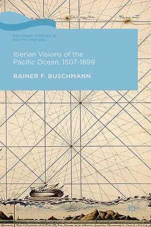
Iberian Visions of the Pacific Ocean, 1507-1899
About this book
Trusted by 375,005 students
Access to over 1.5 million titles for a fair monthly price.
Study more efficiently using our study tools.
Information
1
On Shrinking Continents and Expanding Oceans
If upon bare suspition Christoferus Columbus did pursue his designe with so much obstinancie, you are not to account it strange in me if the things which I have beheld with mine eyes, and touched with mine hands, doe put some kind of constraint upon me to be importune.
Pedro Fernández de Quirós – 1617 [1609]
That Genoese who, in the service of Spain, attempted, and that Portuguese who, in the same service, effected the circumnavigation of the globe, have precluded all competition in honour of sublime discovery. Much, however, is still within the power of men who may be rather emulous of the glorious spirit of that age, than devoted to the mercenary or indolent disposition of the present.
Alexander Dalrymple – 1767
Quirós’s Austral lands
In October of 1607, Portuguese navigator Pedro Fernández de Quirós took an ambitious proposal for a settlement in the Austral lands to the Spanish capital. In it, he envisioned a colony numbering well over one thousand individuals including settlers, soldiers, and Franciscan missionaries. Quirós proposed that the sum of 500,000 ducats would more than pay for this important venture, an astronomical bill that greatly troubled the illustrious members of the Council of Indies advising King Philip III on his overseas policies. Unsurprisingly, Quirós’s plan faced stern opposition. For the better part of seven years, he quibbled with the council’s notables, writing numerous memorials in defense of his endeavor. It was to no avail, however, as Philip III ultimately passed the problem on to his associated American kingdoms. While officially supportive of Quirós’s proposal, the King asked the navigator to sail to Peru where he was to wait for further instructions. Quirós’s fear that council members were conspiring to hasten his departure from this earthly realm became a self-fulfilling prophecy. Much to the relief of his detractors, he expired in Panama en route to his final destination of Lima.
In the histories chronicling the European exploration of the Pacific, Quirós always marks the apex of Spanish hegemony over this ocean. Over the course of the seventeenth century, the Spanish Crown gradually withdrew from exploratory ventures in the Pacific allowing northern European countries to fill the void. Spanish officials, the argument goes, feared overextension and jettisoned costly Pacific ventures, while Dutch, English, and French nationals were braving this ocean’s waters. In the pages below, I argue that this view only partially captures a distinct Spanish vision of the Pacific that contrasts sharply with that of the northern European nations.
Historians frequently regard the eighteenth-century exploration of the Pacific Ocean as a conceptual watershed. Most explorations performed prior to this time period, they argued, sailed with the explicit aims to locate mineral wealth, to gain indigenous converts, and to bestow immortal glory on their navigators. Those following in their wake, however, alleged loftier goals. Inspired by the enlightened purpose to uncover and disseminate knowledge for the sake of knowledge itself, the eighteenth-century voyages were aided by better instruments and novel taxonomic ideas. Scientific innovations determined this process. Central to this epistemology was an unbridled thirst for knowledge and a border-transcending spirit of inquiry that sought to encompass the globe in all its physical and natural dimensions. Lastly, a new spirit of dissemination aimed to promote an intellectual dialogue about natural history in all of its facets. Recent writings, however, have undermined the place of pure knowledge in the motivations for the Franco-British expeditions, arguing that, behind the veil of disinterested investigation lurked equally strong desires for imperial annexation suggesting then a great deal of continuity with earlier exploratory ventures.1
Departing from this assessment, I propose to investigate in this chapter the legacy and impact of the Spanish expeditions to the Pacific in the sixteenth and seventeenth centuries, thus providing a solid foundation for what follows in the book. Later generations of British and French intellectuals who compiled literature on Spanish voyages found many of the early Iberian approaches wanting. Among other things, intellectuals scolded the Spanish policy that prevented immediate dissemination of knowledge. These intellectuals also presented the abuses of Iberian rule in the Americas as a negative example to be avoided.
Yet, before the Pacific became better known through such illustrious voyagers as Bougainville, Cook, and the ill-fated La Pérouse, it had emerged as a conceptual space in the wider European imagination. Historical investigations about the conceptualization of the Pacific are legion and generally serve to preface the equally numerous works on Franco-British expeditions.2 What follows builds on this extensive and still expanding body of literature. It also reads these works against the neglected Spanish vision of the Pacific. Most historians of the Pacific maintain the Spanish conceptualization to be crucial only until the early seventeenth century, when it was superseded by Dutch, English, and French accounts. I maintain, on the other hand, that the argument of a declining Spanish Pacific power entailed in the northern European accounts is only partially correct. A more nuanced rendition traces Iberian initial fascination with the Pacific to a program of maritime expansion and exploration that originated in the Atlantic Ocean and continued well into the seventeenth century through the evangelical agendas of both Franciscan and Jesuit religious officials. By the second half of the seventeenth century, however, Spanish officials raised serious doubts about the existence of legendary continents in the Pacific Ocean. This Spanish doubt and introspection was, ironically, paralleled by an uninhibited northern European enthusiasm about the potential of the South Sea as an area of prosperous economic exchange. In sum, this chapter reads the well-established Dutch, French, and British accounts of early Pacific exploration against the neglected Iberian renditions.
The dual exploration of the Pacific Ocean
The Pacific Ocean is the largest geographical feature on earth, covering a surface almost equal to that of the Arctic, Atlantic, and Indian oceans combined.3 Its settlement and exploration also differ greatly from that of the Atlantic and Indian counterparts. The continuities of historical events linking the liquid spaces of the Atlantic and Indian oceans are well explored and documented in prominent world historical texts. For the Indian Ocean, the decoding of the monsoon system in the first millennium BCE was crucial in the establishment of an exchange system, linking Africa and Asia, that lasted well into the eighteenth century.4 The Atlantic Ocean possesses a smaller but equally continuous timeframe of historical development. From Columbus’s voyages in the late fifteenth century throughout the revolutions of the nineteenth century, the Atlantic stayed central to global history.5 On an historical scale, the Atlantic has become synonymous with the early modern world shedding light on both voluntary and involuntary migrations that greatly influenced the Americas, Africa, and Europe.
If one were to read the history of the Pacific Ocean against its better studied Atlantic and Indian counterparts, some apparent differences quickly emerge. Besides the most obvious difference – size – emphasis must be placed on the Pacific as a world of islands. Islands are, of course, a prominent feature also in the Atlantic and the Indian oceans. However, with a few noticeable exceptions, islands in these oceans are generally located in close proximity to nearby continents and are greatly influenced by the historical trajectory of the landmasses. In terms of the Pacific, geographers speak instead of a distinctive rim and a basin. The latter represents a world apart – frequently called Oceania – that form, in the words of the late Tongan writer Epeli Hau`ofa, literally “a sea of islands.”6
Long before Europeans even caught a glimpse of this watery world, Austronesian voyagers had braved the “tyranny of distance” separating the islands of Southeast Asia from the distant landmasses in Eastern Polynesia.7 Numerous Austronesian crews were lost to the unpredictable elements, although the scourge affecting European crews – a vitamin deficiency illness known as scurvy – seems to have been less prevalent among these first settlers. Their continued journey into the vast expanses of the Pacific Ocean stretched from Island Southeast Asia, over the Fiji-Samoa-Tonga triangle, to the outer limits of Polynesia, including Hawai`i, Aotearoa (New Zealand), and Easter Island (Rapa Nui) and took the better part of four millennia. The Austronesian expansion neared its end by about 700 CE, yet some archeologists now surmise that the ancestors of the Polynesian settlers must have reached the shores of the Americas a good 500 years before Christopher Columbus’s voyage across the Atlantic Ocean. Regional exchange systems abounded in the island world of the Pacific, but integration of this watery realm into a wider global system fell to the Iberian arrival.
European voyages into the Pacific followed the pattern set by Iberian navigators in the fifteenth century. Propelled by the promises of riches along the west coast of Africa and the Indian Ocean, they set out to investigate the winds and currents of the Atlantic Ocean. Initially, their operation involved a considerable amount of island hopping utilizing the Madera, the Azores, the Cape Verde, and the Canary islands. The idea of sailing further west was partially inspired by the rediscovery of Ptolemy’s geographical conception, which argued that all ocean waters were, in fact, surrounded by landmasses. This idea gained further currency when a treaty signed in 1479 excluded Castile from the lucrative business of the African coasts. A little over a decade later, Christopher Columbus sailed west and reached land that he thought to be the eastern edge of Asia. Immediately following Columbus’s arrival in the Americas, Pope Alexander VI published the famed Bull Inter Caetera (1493), which sanctioned expansion based on the principle of indigenous conversion. The Bull received legitimacy from the Treaty of Tordesillas (1494) that divided the Atlantic Ocean into distinctive Portuguese and Spanish spheres.
Martin Waldseemüller’s Universalis Cosmografia (1507) is credited to be one of the first maps to bestow the name “America” on the landmass located by Columbus. At the same time, Waldseemüller’s separation of “America” from Asia served as a conceptual midwife to the Pacific. While the German cartographer still greatly underestimated the distance between Asia and the Americas, the waters separating the continents, littered as they were with islands, remained nameless, but conceptually present.8 The first European to catch a glimpse of Waldseemüller’s imagined space was Vasco Núñez de Balboa in 1513 during his crossing of the Isthmus of Panama. Balboa claimed the Pacific for Spain and christened it el Mar del Sur, a term that still haunts the pages of many works of history. This initial name for the Pacific emerged, however, as a simple opposition to el Mar del Norte or the very sea crossed by the Spaniards to reach the Americas.9
Balboa’s undertaking was quickly followed by Ferdinand Magellan’s circumnavigation (1519–1522), which raised uncomfortable questions for geographers. Magellan’s voyage challenged the age-old Ptolemaic model of cartography that assumed the world’s oceans were surrounded by continental landmasses. The Portuguese mariner’s crossing of the Pacific also provided the name for this vast seascape and required new cartographic imaginations for the first time. Perhaps most importantly, Juan Sebastian el Cano’s return to a Spanish port aboard the last surviving vessel, the Victoria, revealed the existence of a new route to the spice-rich islands of the Indian Ocean, contesting the initial division between Spain and Portugal concerning the Atlantic Ocean. Several Spanish expeditions followed in Magellan’s wake to lay claim to these wealthy islands in Southeast Asia, yet their voyages failed to locate favorable winds for a return passage to the Americas. Before this tornaviaje was found, officials in Portugal and Spain negotiated an additional treaty (Zaragoza 1529), in which Charles V of Spain forewent his claim over the Maluku Islands in return for a sizable Portuguese monetary payment.10 This treaty placed much of the Pacific under Spanish control, inducing historians to label the area as a “Spanish Lake,” even if this term greatly exaggerated the amount of Spanish hegemony over the region.11
Magellan’s circumnavigation may have ended the myth of landlocked oceans, yet it allowed for the emergence of an equally persistent chimera from the sea of classical writings: The Southern Continent. Fuelled by an old geographical argument that the landmasses in the northern hemisphere needed to be balanced by similar terrestrial continents in the south, this “equilibrium theory” placed an imaginary, not yet contacted, continent on sixteenth century maps of the world. There it languished as Terra Australis Incognita. Similarly, Spanish research into Inca history revealed Native American expeditions to gold-rich islands located in the Pacific Ocean. These stories combined with geographical myths to propel a large-scale Spanish effort to explore the southern Pacific between 1567 and 1606.12
Serendipity: contextualizing Spanish journeys to the Tierras Australes
The Spanish voyages initiated in the late fifteenth century demanded new ways of organizing the world. Growing information about the Pacific could only add to the sheer overwhelming amount of knowledge that reached the Iberian Peninsula during the sixteenth century. In Spain, cosmographers were entrusted with the task of organizing this knowledge into meaningful categories and quickly realized the limitations and deficiencies of existing classical frameworks. Preference thus shifted to in situ observation and data collection that ...
Table of contents
- Cover
- Title
- Introduction
- 1 On Shrinking Continents and Expanding Oceans
- 2 On Chronometers, Cartography, and Curiosity
- 3 On Narrating the Pacific
- 4 On the Usefulness of Information
- 5 On History and Hydrography
- 6 On Rediscovering the Americas
- Epilogue: Iberian Visions of the Pacific Ocean, 15071899
- Notes
- Bibliography
- Index
Frequently asked questions
Yes, you can cancel anytime from the Subscription tab in your account settings on the Perlego website. Your subscription will stay active until the end of your current billing period. Learn how to cancel your subscription
No, books cannot be downloaded as external files, such as PDFs, for use outside of Perlego. However, you can download books within the Perlego app for offline reading on mobile or tablet. Learn how to download books offline
Perlego offers two plans: Essential and Complete
- Essential is ideal for learners and professionals who enjoy exploring a wide range of subjects. Access the Essential Library with 800,000+ trusted titles and best-sellers across business, personal growth, and the humanities. Includes unlimited reading time and Standard Read Aloud voice.
- Complete: Perfect for advanced learners and researchers needing full, unrestricted access. Unlock 1.5M+ books across hundreds of subjects, including academic and specialized titles. The Complete Plan also includes advanced features like Premium Read Aloud and Research Assistant.
We are an online textbook subscription service, where you can get access to an entire online library for less than the price of a single book per month. With over 1.5 million books across 990+ topics, we’ve got you covered! Learn about our mission
Look out for the read-aloud symbol on your next book to see if you can listen to it. The read-aloud tool reads text aloud for you, highlighting the text as it is being read. You can pause it, speed it up and slow it down. Learn more about Read Aloud
Yes! You can use the Perlego app on both iOS and Android devices to read anytime, anywhere — even offline. Perfect for commutes or when you’re on the go.
Please note we cannot support devices running on iOS 13 and Android 7 or earlier. Learn more about using the app
Please note we cannot support devices running on iOS 13 and Android 7 or earlier. Learn more about using the app
Yes, you can access Iberian Visions of the Pacific Ocean, 1507-1899 by R. Buschmann in PDF and/or ePUB format, as well as other popular books in History & Australian & Oceanian History. We have over 1.5 million books available in our catalogue for you to explore.