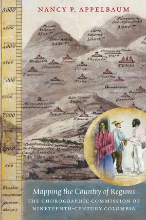
The nineteenth century was an era of breathtakingly ambitious geographic expeditions across the Americas. The seminal Chorographic Commission of Colombia, which began in 1850 and lasted about a decade, was one of Latin America’s most extensive. The commission’s mandate was to define and map the young republic and its resources with an eye toward modernization. In this history of the commission, Nancy P. Appelbaum focuses on the geographers' fieldwork practices and visual production as the men traversed the mountains, savannahs, and forests of more than thirty provinces in order to delineate the country’s territorial and racial composition. Their assumptions and methods, Appelbaum argues, contributed to a long-lasting national imaginary.
What jumps out of the commission’s array of reports, maps, sketches, and paintings is a portentous tension between the marked differences that appeared before the eyes of the geographers in the field and the visions of sameness to which they aspired. The commissioners and their patrons believed that a prosperous republic required a unified and racially homogeneous population, but the commission’s maps and images paradoxically emphasized diversity and helped create a “country of regions.” By privileging the whiter inhabitants of the cool Andean highlands over those of the boiling tropical lowlands, the commission left a lasting but problematic legacy for today’s Colombians.
eBook - ePub
Mapping the Country of Regions
The Chorographic Commission of Nineteenth-Century Colombia
- 320 pages
- English
- ePUB (mobile friendly)
- Available on iOS & Android
eBook - ePub
Mapping the Country of Regions
The Chorographic Commission of Nineteenth-Century Colombia
About this book
Trusted by 375,005 students
Access to over 1.5 million titles for a fair monthly price.
Study more efficiently using our study tools.
Information
Chapter 1: Distinguished Citizens of the Illustrated World
Creation and Composition of the Commission
It might seem counterintuitive to view a commission led by a foreign-born military engineer, Agustín Codazzi, as incarnating the Colombian elite’s nation-building aspirations. But while the commission was shaped profoundly by Codazzi’s expertise and ideas, it was also influenced by the national context in which it operated. The commission was composed of an ever-shifting group of between two and four official members, both native- and foreign-born, and supported by additional unofficial contributors and workers.1 They adhered to different and often opposing political factions. Consistently patriarchal and stratified by class, the commission was simultaneously parochial, national, and cosmopolitan, as well as both Liberal and Conservative. Indeed, Codazzi often seemed to embody all of these impulses.
This chapter lays out the origins of the Chorographic Commission, placing it within the larger trajectory of geographic science in New Granada, which predominantly emphasized the superiority of the Andean climates and inhabitants over those of other regions. The chapter introduces Codazzi and the other official members of the commission as well as its principal sponsors and some of its unofficial participants. These individuals practiced geographical science while also practicing politics, warfare, and the arts. They participated actively in the midcentury tumults and transformations that turned New Granada into Colombia. The chapter concludes by examining the relationship between the commission and the most significant political transformation of the era: the transition to federalism.
CREOLE GEOGRAPHY
Historians of Colombian republican geographical science often start with Francisco José de Caldas, a pioneering Enlightenment-era intellectual from the southwestern city of Popayán who collaborated with both José Celestino Mutis and Alexander von Humboldt. Caldas edited the scientific journal Semanario del Nuevo Reino de Granada (1808–1810), one of several periodicals founded by late-colonial creoles (criollos, which at that time usually referred to whites born in the New World). It published research on the Viceroyalty’s territory and resources. The first edition started with an essay on the “State of the Geography of the Viceroyalty of Santafé de Bogotá,” which opened with Caldas’s famous and oft-quoted manifesto, in which he defined geographic knowledge as “the thermometer that measures the enlightenment, commerce, agriculture, and prosperity of a people.”2 Geography was “the fundamental base of all political speculation,” which measured the size of the country and studied the “peoples of the land, the goodness of its coasts, the navigable rivers, the mountains [that] cross it, the valleys that they form, the reciprocal distances between the settlements, the established roads . . . climate, temperature, the altitude above sea level of all points, the temperament and customs of the inhabitants, the spontaneous products, and those which can be domesticated.”3 Thus Caldas laid out the objective and content of patriotic geographic science and its centrality to building and governing a prosperous and enlightened society. Although Caldas and his collaborators had not yet broken with Spain, they made clear that any would-be governing elite must know its own territory. Caldas proposed a “geographic-economic” expedition composed of an astronomer, a botanist, a geologist, a zoologist, an economist, and illustrators to traverse the Viceroyalty, which never came to fruition.4
Like Humboldt, whose work the Semanario republished and with whom Caldas had collaborated (and quarreled), Caldas mapped plants and climates by altitude. His essays, moreover, were infused with enthusiasm about his homeland—the same enthusiasm that would lead him, a few years later, to become an ardent patriot and martyr for Independence. He celebrated New Granada’s mountains for the diverse climates they produced, without which the viceroyalty would consist of a “melancholic and eternal hot lowland plain.”5
Our Andes are the origin of incalculable benefits, our Andes give us all the delicacies, our Andes moderate us, vary us. . . . Temperature, air density, meteors, fruits, animals, uses, ingenuity, customs, features, color, virtues, vices, all vary with level. There are few points on the surface of the globe more advantageous to observe, and I can say feel, the influence of climate and foods on the physical constitution of man, on his character, virtues, and vices [emphasis in original].6
Caldas thus argued that New Granada’s highly varied topography provided an ideal laboratory in which to test European theories.7 He vindicated creole science by emphasizing the importance of direct observation and experimentation, which creoles were uniquely positioned to do,8 and he vindicated the New World environment—or at least part of it. Influenced by Enlightenment thinkers such as Montesquieu and Buffon, while emphasizing his own empirical observations, Caldas concluded that the climate had a strong influence on the human body.9 (By climate he and others referred to not only temperature but all aspects of what we would now call the natural environment).10 He differed in part from Buffon’s negative view of the Americas by emphasizing that the temperate climate of the Andean highlands “moderated” their tropical inhabitants, allowing some civilizations to emerge that were not inferior to those of Europe.11 Thus, according to historian Alfonso Múnera, Caldas and his collaborators created a “hegemonic discourse of the Andean republic, in which the valleys and highlands of the great cordilleras embodied the ideal territory of the nation, while the coasts, the hot lands of the river valleys, the plains and the forests [were] the ‘other,’ the negative image of an inferior America.”12 Caldas championed some areas of New Granada (the temperate highlands) at the expense of others (the hot lowlands).
Caldas did not live to see the new republic. Royalist forces executed him in 1816.13 In the 1840s, the New Granada historian, geologist, and cartographer Joaquín Acosta published the Semanario as a book, which circulated among the small midcentury intelligentsia.14 Educated Granadinos were therefore familiar with Caldas’s ideas about the importance of geographic knowledge and the relationship between people and their environment.
Recently, scholars have been documenting and analyzing the production of early republican cartography to argue that Colombia’s rich legacy of nineteenth-century geographical practices “neither began nor ended with Codazzi.”15 They document the production of local and national maps during the Independence period and the first Republic of Colombia (1819–1830), which historians now refer to as Gran Colombia (it included present-day Venezuela and Ecuador).16 In 1824, José Manuel Restrepo, the Minister of the Interior under Simón Bolívar and former collaborator with Caldas, led the production of a manuscript map titled Chorographic Map of the Republic of Colombia, based on various preexisting maps. This formed the basis for the published Map of the Republic of Colombia, which he included in his 1827 atlas.17
The separation of New Granada from Ecuador and Venezuela in 1830 brought more efforts to stimulate science in service of the state.18 Provincial maps indicating boundaries of provinces and cantons were produced.19 Meanwhile, some of New Granada’s leading elite intellectuals—including men such as Acosta, Tomás Cipriano de Mosquera, Francisco Antonio Zea, and José María Samper—created national maps and geographical texts.20 All of the best-known geographers were elite men, but women also participated in geographical culture in contexts ranging from elite salons to school classrooms, as well as by writing costumbrista literature, and non-elites participated in many ways as well.21
Acosta was New Granada’s leading geographer and scientist. He studied mathematics, geology, and engineering in Paris, where he published articles and collaborated with Humboldt. Acosta compiled an influential national map in 1847 from published maps, archival documents, and unpublished measurements provided by other scientists with whom he worked, such as the French geologist Jean Baptist Boussingault.22 To those sources he added his own geographical measurements.
In 1839, as Codazzi finished mapping neighboring Venezuela, New Granada’s lawmakers authorized the appointment of “two engineers” from within or outside of the country to produce a national map and provincial maps, along with a descriptive text.23 The legislators who sponsored this legislation included Mosquera and José Hilario López—the two future presidents whose successive administrations would initiate the Chorographic Commission a decade later.24 The law cited the need for an accurate division of the country to facilitate public administration and stated that “the administration and alienation of public lands also requires measurement and knowledge.”25 The legislation reflected a search on the part of early republican leaders for the best way to divide up and administrate the country and an emerging elite consensus that New Granada’s future prosperity lay in privatizing public and communal lands as well as promoting export agriculture and mining. The maps and descriptions of New Granada were to emphasize “above all its products and natural riches.”26 Another decade would pass, however, before the government of New Granada could actually manage to launch its own commission under the leadership of Agustín Codazzi.
THE FOUNDING MEMBERS: ANCÍZAR AND CODAZZI
Institutionally and economically, the Republic of New Granada found itself on weak footing after the Independence wars and breakup of Gran Colombia. Granadinos, who reportedly numbered around two million in 1843, struggled to rebuild.27 The treasury was impoverished and much of the infrastructure, such as it was, had fallen apart. Civil strife wreaked further havoc on the economy. Mosquera’s first presidential administration (1845–1849) sought to boost exports, especially of gold and tobacco, by lowering trade barriers and initiating steamship transportation on the Magdalena River. He promoted technical training for the elite and the immigration of foreign experts. Among his modernization initiatives, Mosquera invited to New Granada the two founding members of the Chorographic Commission, first Manuel Ancízar and then Agustín Codazzi, both of whom had been residing in Venezuela.28
Born just outside of Bogotá in 1812, Manuel Ancízar Basterra belonged to a Spanish family that had fled to Cuba during the Independence wars.29 Educated in Havana, where he reportedly dabbled in Freemasonry and plotted against the Spanish crown, he settled in Venezuela in 1834. There, he became an influential educator and writer. Returning to Bogotá in 1847, he served as Mosquera’s Minister of Exterior Relations, founded the periodical El Neo-Granadino, and supported the radical Liberal political faction that came to power in the contentious election of 1848.
Ancízar served on the commission for its first two years. He was supposed to produce a “Geographic-statistic Dictionary,” which he never completed. He also agreed to provide an illustrated “dramatic and descriptive” work that would describe “the geographic expedition in its marches and adventures, the customs, the races in which the population is divided, the ancient monuments and natural curiosities, and all the circumstances worthy of mention.”30 That dramatic work became the commission’s best known text, Pilgrimage of Alpha (Peregrinacion de Alpha). His ironic and somewhat irreverent pen name, Padre Alpha, might have reflected the fact that radical Liberals were seeking to substitute their own secular authority over that of the church. Pilgrimage, of course, implies religious ritual—a sacred journey or quest, though there was nothing overtly religious about Ancízar’s text. Biographer Gilberto Loaiza Cano suggests that Ancízar, who had fled New Granada as a child, was undertaking a personal journal of discovery of his national identity, “a pilgrimage to the nooks and crannies of his previously unknown domain.”31 In 1852, however, he reluctantly left for a diplomatic mission abroad and abandoned the commission. For several years he retained the futile hope of rejoining it.32
Codazzi’s childhood, like Ancízar’s, had been disrupted by war, but unlike Ancízar he embraced warfare by becoming a soldier. Giovanni Battista Agostino Codazzi was born to a merchant family in Lugo in 1793. The city was soon overrun by Napoleon’s forces, who sacked the family home in 1796. Codazzi nonetheless entered Napoleon’s Italian forces while still in his teens. He apparently trained at the military academy at Pavia, joined the mounted artillery, ascended through the ranks of subordinate officers, and fought in bloody campaign...
Table of contents
- Cover Page
- Halftitle Page
- Title Page
- Copyright Page
- Dedication
- Contents
- Figures
- Acknowledgments
- Introduction
- Chapter 1: Distinguished Citizens of the Illustrated World
- Chapter 2: Views of the Country
- Chapter 3: A Homogeneous, Vigorous, and Well-Formed Population
- Chapter 4: A Grave for the White Race
- Chapter 5: The Illustrated and Progressive Spirit of the Granadinos
- Chapter 6: Solitary Deserts
- Chapter 7: The History of These Sublime Cordilleras
- Chapter 8: A Seat among the Savants
- Conclusion
- Notes
- Bibliography
- Index
Frequently asked questions
Yes, you can cancel anytime from the Subscription tab in your account settings on the Perlego website. Your subscription will stay active until the end of your current billing period. Learn how to cancel your subscription
No, books cannot be downloaded as external files, such as PDFs, for use outside of Perlego. However, you can download books within the Perlego app for offline reading on mobile or tablet. Learn how to download books offline
Perlego offers two plans: Essential and Complete
- Essential is ideal for learners and professionals who enjoy exploring a wide range of subjects. Access the Essential Library with 800,000+ trusted titles and best-sellers across business, personal growth, and the humanities. Includes unlimited reading time and Standard Read Aloud voice.
- Complete: Perfect for advanced learners and researchers needing full, unrestricted access. Unlock 1.5M+ books across hundreds of subjects, including academic and specialized titles. The Complete Plan also includes advanced features like Premium Read Aloud and Research Assistant.
We are an online textbook subscription service, where you can get access to an entire online library for less than the price of a single book per month. With over 1.5 million books across 990+ topics, we’ve got you covered! Learn about our mission
Look out for the read-aloud symbol on your next book to see if you can listen to it. The read-aloud tool reads text aloud for you, highlighting the text as it is being read. You can pause it, speed it up and slow it down. Learn more about Read Aloud
Yes! You can use the Perlego app on both iOS and Android devices to read anytime, anywhere — even offline. Perfect for commutes or when you’re on the go.
Please note we cannot support devices running on iOS 13 and Android 7 or earlier. Learn more about using the app
Please note we cannot support devices running on iOS 13 and Android 7 or earlier. Learn more about using the app
Yes, you can access Mapping the Country of Regions by Nancy P. Appelbaum in PDF and/or ePUB format, as well as other popular books in History & Latin American & Caribbean History. We have over 1.5 million books available in our catalogue for you to explore.