Geography
Urban Functions
Urban functions refer to the various activities and roles that cities perform, such as residential, commercial, industrial, and recreational functions. These functions are essential for the functioning and development of urban areas and are often interconnected, shaping the social, economic, and environmental dynamics of cities. Understanding urban functions is crucial for urban planning and sustainable development.
Written by Perlego with AI-assistance
Related key terms
1 of 5
9 Key excerpts on "Urban Functions"
- eBook - ePub
Urban Studies
A Canadian Perspective
- N. H. Lithwick, Gilles Paquet(Authors)
- 2017(Publication Date)
- Routledge(Publisher)
4Basic activities show greater contrasts among urban places than do non-basic activities and thereby serve as a valuable guide to functional classification.5 Examination of basic functions indicates four distinct types of city: (1) central places which provide retail and other tertiary services to their trade areas; (2) transportation centres; (3) manufacturing centres; and (4) special-function centres, such as government, administrative, religious or military centres.6The distribution of basic functions among cities is related to the spatial elasticity of demand for those functions. The spatial elasticity of demand is the measure of distance decay, or the rate at which supply of a good or service from a city declines with distance from that city. Where the elasticity and hence the distance decay are high, as in the case of low-order retail services, the function has a ubiquitous distribution. For high-order manufactured goods, the distance decay is low, and the function becomes sporadic and found in only a few urban places.Urban places with economic functions of a ubiquitous nature can be expected to serve only small functional regions, to have a limited growth potential and to have a regular distribution pattern. Accelerated urban growth depends upon the ability of a city to develop “national-market activities” which have a low distance decay. Walter Isard relates the population rank of a city within a country to the number of national-market area activities which it captures, while at the same time retaining all its “non-national” activities.7The concept of basic functions thus stresses the economic ties which bind a city to its region and which links urban growth to the size of the region. Unfortunately, urban economic base studies have not generally been concerned with identification of the areas to which basic functions export, nor with the concept of functional region.8 - eBook - ePub
City and Society
An Outline for Urban Geography
- R.J. Johnston(Author)
- 2013(Publication Date)
- Routledge(Publisher)
Most societies, and certainly those of North America, Western Europe and Australasia where this ‘new geography’ developed, focus their activities in and on urban places. The majority of economic functions – in manufacturing, administration and service provision – and of social activities take place in towns and cities, and those which do not, notably agriculture, are articulated through the urban places, on which virtually all routes focus and in which most buying and selling occurs. Thus it is not surprising that the study of urban geography was central to the ‘new geography’ of the 1950s and 1960s, and this centrality was encouraged by the increased amount of urban planning undertaken.Urban geographers have developed two main types of research interest during this period of growth in the study of spatial organization, the two types representing analysis at different spatial scales. At the larger scale, they investigate the role of the town within the system of urban places, usually at a national or regional level; at the smaller scale, they analyse the characteristics of different areas within individual towns and cities. These two types are not independent, and methods developed for one have frequently been adopted for the other. Together, they define the current research concerns of most urban geographers.The study of urban places and urban systems
As indicated above, urban geographers have not been concerned simply to catalogue the activities of the residents of the towns that they study; their aim is to make generalizations about such activities, generalizations which apply to a large proportion of, if not all, towns. A large number of different topics is approached within this broad orientation, but they can be grouped into three characteristic concerns. - eBook - PDF
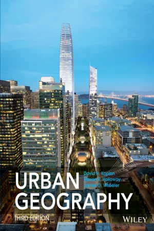
- Dave H. Kaplan, Steven Holloway(Authors)
- 2014(Publication Date)
- Wiley(Publisher)
Fifth, engineering, civil engineering in particular, provides the practical skills that are The Field of Urban Geography 7 Psychology Political Science Sociology Ecology History Archaeology Economics Anthropology Urban Geography Figure 1.3 Urban geography is a synthetic discipline that draws from and contributes to a variety of closely related fields. Source: Authors. needed in the construction and operation of urban environments. Sixth, there is a broad array of non- governmental and nonprofit organizations (NGOs) that attempt to improve the city and its residents. THE FIELD OF URBAN GEOGRAPHY Our discussion so far shows how urban geogra- phy relates to other urban-focused disciplines, but we haven’t been very specific yet about urban geography’s core substantive concerns. Geogra- phers broadly study both the world’s physical and human environments. They explore how humans have altered and are currently altering our nat- ural landscapes, our atmosphere, our water, and our soils. Whereas physical geographers examine landforms (geomorphology), long-term weather trends and patterns (climatology), and the natural and human-modified spatial distributions of plant and animals (biogeography), human geographers focus their attention on the location of people and their activities over geographic space. This locational focus may emphasize economic activi- ties and behaviors, social and cultural features of human society, and political and power relations as expressed in places or over spaces (regions). Urban geography is typically thought of as a subfield of human geography, a subfield that studies cities or urban areas. Today, however, urban geographers are increasingly concerned with the interrelationship between cities and biophysical processes, and with concepts of sustainability and resilience, which represents a bridging between human and physical geography. - eBook - PDF
Human Geography
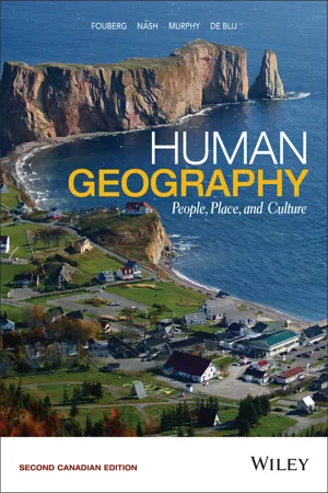
People, Place, and Culture
- Erin H. Fouberg, Alexander B. Nash, Alexander B. Murphy, Harm J. de Blij(Authors)
- 2015(Publication Date)
- Wiley(Publisher)
In this chapter, we focus on the processes of urbanization— how and why people began living in cities, and how cities change over time. We are interested in why cities are located where they are and the reasons for their internal form and function. We also consider how cities evolve and how their rela- tionships with each other vary across a variety of scales—local, regional, national, and global. Urban geographers, with their spatial perspective, focus on the location of cities, their regional Urban (area) The entire built-up, non-rural area and its population, including the most recently constructed suburban appendages. Provides a better picture of the dimensions and population of such an area than the delimited municipality (central city) that forms its heart. Suburban realm The surrounding environs connected to the city. Mega-city A city having a population of more than 10 million inhabitants. Urban agglomerations Defined by the United Nations as those populations of 1 million or more people “within a contiguous territory inhabited at urban levels of residential density.” 10.1 When and Why Did People Start Living in Cities? 277 Agricultural surplus Agricultural production in excess of that which the producer needs for his or her own sustenance and that of his or her family and which is then sold for consumption by others. One of two components, together with social stratification, that enable the formation of cities. Social stratification The differentiation of society into classes based on wealth, power, production, and prestige. One of two components, together with agricultural surplus, that enables the formation of cities. interconnections, movements between and within cities, and the sense of place people have about cities and the landscapes they inhabit. - eBook - ePub
Urban Geography
A Global Perspective
- Michael Pacione(Author)
- 2009(Publication Date)
- Routledge(Publisher)
PART ONE The Study of Urban Geography 1 Urban Geography from global to local Preview: the study of urban geography; global triggers of urban change—economy, technology, demography, politics, society, culture, environment; globalisation; localisation of the global; the meaning of geographic scale; local and historical contingency; processes of urban change; urban outcomes; why study urban geography? INTRODUCTION Urban geography seeks to explain the distribution of towns and cities and the socio-spatial similarities and contrasts that exist between and within them. If all cities were unique, this would be an impossible task. However, while every town and city has an individual character, urban places also exhibit common features that vary only in degree of incidence or importance within the particular urban fabric. All cities contain areas of residential space, transportation lines, economic activities, service infrastructure, commercial areas and public buildings. In different world regions the historical process of urban evolution may have followed a similar trajectory. Increasingly, similar processes, such as those of suburbanisation, gentrification and socio-spatial segregation, are operating within cities in the developed world, in former communist states and in countries of the Third World to effect a degree of convergence in the nature of urban landscapes. Cities also exhibit common problems to varying degrees, including inadequate housing, economic decline, poverty, ill health, social polarisation, traffic congestion and environmental pollution. In brief, many characteristics and concerns are shared by urban places. These shared characteristics and concerns represent the foundations for the study of urban geography - eBook - PDF
- Mohamed Samer(Author)
- 2016(Publication Date)
- IntechOpen(Publisher)
Up to 12 generic services are defined, which are subdivided into 22 functions and 22 goods and services. To quantify the functionality of peri-urban agricultural systems we propose 36 indicators that cover the three components of the concept (economic, social and environmental). Some of these indicators are defined from previous studies around sustainable agriculture. There are some papers which propose indicators to economic and environmental analysis but do not com‐ pletely cover the selected aspects of multifunctionality. In order to yield a broader coverage, we include new indicators defined specifically for the analysis of the peri-urban agriculture particularities. Specifically, indicators related to territorial aspects of the special location of these agricultural systems, and pressures to which they are subject. Other indicators related to the education and cultural function that these agricultural systems can provide to the hipsters. Identifying Functionality of Peri-Urban Agricultural Systems: A Case Study http://dx.doi.org/10.5772/62725 83 From descriptive approach for the functionality of peri-urban agricultural systems derive that these can´t be considered as an economic activity sensu stricto . On the other hand, society demands of these opportunities to undertake recreational activities, produce quality organic products locally, conserve and maintain spaces relatively near cities and towns under suitable environmental conditions for living, conserving cultural ethnological heritage, etc. The planners and political decision makers should consider society demands and the contri‐ bution from peri-urban system to the economic, socio-ecological, psychological, cultural, and spiritual welfare of the urban community. So, to planners, it is important to determine functions and services actually, in the peri-urban system. Then, it can determine social preferences for them though determining social welfare function. - eBook - ePub
Sustainable Urban Development Volume 2
The Environmental Assessment Methods
- Mark Deakin, Gordon Mitchell, Peter Nijkamp, Ron Vreeker(Authors)
- 2007(Publication Date)
- Routledge(Publisher)
Urbanisation economies and shopping externalities are particularly likely to result from multi-functional land use. Obviously, historical development and topographical features do not change as a result of the combination of functions in space. The final factor technological development is an important reason for the development of the concept of multi-functional land use. Not only improvements in construction techniques, but also developments in ICT possibilities have created new insights into opportunities for combining economic activities. Another important element must be taken into account concerning location decisions and multi-functional land use: scarcity of land. The scarcity of land is an important reason for the development of multi-functional land use. People do not want only to live in densely populated areas, but also want to be able to work, shop, move around, etc. in order to maximise their utility. If all these different activities have to be carried out in a limited space, land use functions will have to be combined (e.g., by using the third and/or fourth dimension). This type of development corresponds with one of the main characteristics of the urban economy – the interdependence of land uses, which is largely created by external economies and diseconomies of production and consumption. These interdependencies bring about entirely different uses and values in areas with the same level of general accessibility. The theories on the concentric ring pattern of the spatial distribution of land use and the smooth pattern of the rent gradient may, therefore, have to be modified. The spatial distribution of land use patterns can be expected to become far more patchy as complementary land use patterns are gathered together in specific parts of the city where they can more easily enjoy the benefits of their proximity - Kurt W. Bauer(Author)
- 2009(Publication Date)
- CRC Press(Publisher)
As used in this text, city planning is directly concerned only with physical develop-ment. It does not attempt to establish the basic policies to be pursued with respect to the social and economic development of the community. It does, however, provide the facilities for such development and thereby greatly influences the quality of the activities concerned. Thus, under the viewpoint adopted in this text, the core functions of the urban planner consist of the preparation of plans for the physical development of urban areas, includ-ing the land use, transportation, utility and community facility elements of such plans, and the preparation and administration of plan implementation devices, including zoning, official mapping, land subdivision control, and capital improvement programming. City planning is nevertheless aimed at fulfilling social and economic objectives that go beyond the physical form and arrangement of buildings, streets, parks, utilities, and other parts of the urban environment. City plan-ning takes effect largely through the operations of government and requires the application of specialized techniques of survey, analysis, forecasting, and design. It has therefore also been described as a social movement, as a gov-ernmental function, and as a technical profession. Each such view of city planning has its own concepts, history, and theories. 22 City Planning for Engineers and Surveyors City Planning as a Team Effort Even when conceptually limited to dealing with the physical development of urban areas, city planning is so broad in scope that few individuals can master all of the disciplines and professional skills required for its suc-cessful execution. Urban planning, at least for metropolitan areas and for larger cities, is therefore best practiced through interdisciplinary staffs that can operate as teams to perform the functions and address the issues concerned.- eBook - ePub
Energizing Sustainable Cities
Assessing Urban Energy
- Arnulf Grubler, David Fisk(Authors)
- 2012(Publication Date)
- Routledge(Publisher)
The urbanization indicators adopt a necessarily narrow definition of urban activities as those taking place within the spatial urban boundaries consistent with the available spatially explicit socio-economic data sets. For instance, the final energy use estimates refer to the direct use of final energy (fuels and electricity) in urban areas and excludes upstream energy conversion losses (e.g. in electricity generation) and energy embodied in raw material and goods imported into urban areas 2 for which spatially explicit data sets or estimates are unavailable. Adopting a multi-dimensional perspective on urbanization reveals that in terms of economic activity, energy use, and technological infrastructures the world is already predominantly urban today and is bound to yet further urbanize in the future. 2.3 Urbanization in a historical context Cities have existed for millennia. Cities and their associated urban agglomerations have and continue to play key roles as centers of government, production, and trade, as well as knowledge, innovation, and productivity growth (UN 2008). Yet during most of the past, the number of city dwellers remained exceedingly small — the majority of the population continued to live in rural areas and undertook manual labor in agriculture. Before 1800 large cities (by contemporary standards) were exceedingly rare, with Chang'an and Baghdad likely the first examples of cities that approached one million inhabitants (Chandler and Fox 1974; Chandler 1987). This started to change dramatically with the (rapid) improvement of agricultural labor productivity, which displaced people to new industrial jobs and migration into cities (the Industrial Revolution). It needs to be noted that historically, the economic structural shift away from agricultural employment significantly preceded the corresponding shift towards urban residence, albeit the development lags became shorter over time (Figure 2.1)
Index pages curate the most relevant extracts from our library of academic textbooks. They’ve been created using an in-house natural language model (NLM), each adding context and meaning to key research topics.
