History
The Great Plains geography
The Great Plains is a vast expanse of flat grassland covering parts of the United States and Canada. It is characterized by its relatively low relief and lack of trees, making it ideal for agriculture and ranching. The region is known for its extreme weather, including harsh winters and frequent tornadoes, and is home to diverse wildlife and indigenous cultures.
Written by Perlego with AI-assistance
10 Key excerpts on "The Great Plains geography"
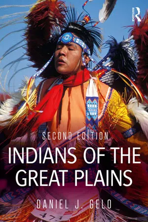 eBook - ePub
- Daniel J. Gelo(Author)
- 2018(Publication Date)
- Routledge(Publisher)
Chapter 1The Great Plains
The Plains landscapeKnowledge of the environment must be the basis for any discussion of Plains Indian culture. In Plains landforms, weather, animals, and plants, we see the origins of Indian migration patterns, adaptations, tools, hunting practices, and house styles. And, it is not too much to say that language, thought, and religious symbolism—elements often included under the term “worldview”—are also influenced by natural surroundings.The early Plains anthropologist Clark Wissler (1870–1947) noted that culture “approaches geographical boundaries with its hat in its hand.” Recognizing the influence of geography or environment on culture requires caution, however. It would be a mistake to think that surroundings strictly determine the cultural development and customs of a people, when humans show great adaptability and their prior customs can persist under new circumstances. Another pitfall is the concept that certain people have a unique relationship to nature resulting from some exclusive mystical or spiritual outlook. It is possible to appreciate Indian knowledge and respect for nature without regarding them as superhuman. Like any environment, the Plains region presents a distinct set of opportunities and limits to the humans who encounter it. Exploring the physical characteristics of the region is a good way to start understanding those who live there.Where and what are the Plains? There have been several attempts to determine the boundaries of the region in geographic and ecological terms. A good starting point is the outline offered by the historian Walter Prescott Webb in his classic work The Great Plains (1981; orig. 1931). Webb tells us that a plains environment has three characteristics: 1) it is a comparatively level surface of great extent; 2) it is unforested; and, 3) its rainfall is not sufficient for ordinary intensive agriculture. In North America, a level surface extends for the most part between the Appalachian and Rocky Mountains. The unforested area of the continent, however, is mostly west of the Mississippi. It begins at the timber line, an artificial boundary where deep woods yield to brush and grass, running on the east generally between the 94th and 98th meridians (east Texas and Oklahoma, western Missouri and Minnesota) but veering east to the 87th meridian around 40°N, or the area around Iowa and Illinois. Not counting the timber of the Rocky Mountains, this unforested zone extends west to the Sierras and Coast ranges of California, Oregon, and Washington. The dry zone of the continent extends from the 20-inch rainfall line, the so-called humid line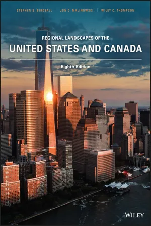 eBook - PDF
- Stephen S. Birdsall, Jon C. Malinowski, Wiley C. Thompson(Authors)
- 2017(Publication Date)
- Wiley(Publisher)
Asked to name the physical region in which they live, residents usually give a more local area than “the Great Plains.” Thus, a Texan may say he lives on the Staked Plains. A Kansan will reply that she lives in the Gypsum Hills. A Nebras- kan may reply “the Platte Valley” or “the Sand Hills.” The Great Plains as a broader region is substan- tially an academic invention of the twentieth century. It is an idea used to frame responses to the widespread economic and environmental problems that developed in this part of the United States during the Depression years of the 1930s. Built on the powerful image of “the Great American Desert” and reinforced by literature and film, the Great Plains entered Americans’ concep- tual framework of regions. 2 Ibid., pp. 156–157. GRASSLANDS LITERATURE 235 One major result of the development of the Great Plains idea as a broad umbrella term has been extension of the belief that the Great Plains environment is uni- form and monotonously flat. This verdict is reinforced for many travelers crossing the region by car. Two of the most traveled east‐west routes across the United States, I‐40 and I‐80, pass through the Staked Plains and the Platte River valley, respectively. These areas are flat and arguably the least attractive parts of the Great Plains. In truth, the Great Plains and prairies possess substantial variation in landscape. The Sand Hills of Nebraska, the Badlands of South Dakota, the Alberta uplands, the Manitoba lowland—these are a few exam- ples of Great Plains landscapes that are different both geologically and in their appearance. Another misconception of the Great Plains and prairies is that all its residents share the same ethnic background. This, too, like images of a homogeneous physical environment, is not the case. Many parts of the region are strikingly diverse, especially in Canada where recent immigration played an important part in the prairies’ population growth.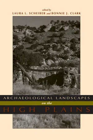 eBook - PDF
- Laura L. Scheiber, Bonnie J. Clark, Laura L. Scheiber, Bonnie J. Clark(Authors)
- 2009(Publication Date)
- University Press of Colorado(Publisher)
In it we pres-ent research that bridges the arbitrary division between history and prehistory. The decision to focus on long-term change allows the authors to consider both ethnographic literature and environmental data of a deep time depth, which are strengths of Plains research. The result is a cohesive and synthetic group of case studies spanning thousands of years of human occupation. What is unique about this book is that it focuses on one particular geographic region, and it explores the different and changing ways people interacted with that place. THE HIGH PLAINS The High Plains lie between the Rocky Mountains to the west and the tall-grass prairies to the east and include portions of the modern states of Wyoming, Colorado, Nebraska, Kansas, Oklahoma, New Mexico, and Texas. The stan- A Sloping Land: An Introduction to Archaeological Landscapes on the High Plains dard spatial definition of the High Plains follows definitions of the section of the Great Plains physiographic province, extending from the Pine Ridge Escarpment at the South Dakota/Nebraska border to the Llano Estacado in the Texas and Oklahoma panhandles (Fenneman 1931; Holliday et al. 2002). Because of great physical, climatological, and cultural similarities between the High Plains section and the area between it and the Rocky Mountains, we have expanded our area of concern to the three westernmost physiographic regions of the Great Plains as well—the Colorado Piedmont, Raton, and Pecos Valley sections (Figure 1.1). When we write of the High Plains in this volume, we are referring to that expanded area. A tilted landscape, the High Plains gently slope as they rise from a low elevation of around 750 m (2,461 ft) above sea level along their eastern edge to 1,800 m (5,906 ft) where they meet the foothills of the Rockies (Trimble 1980). The area is a remnant of a vast plain formed by sediments deposited by streams flowing east from the ancestral Rocky Mountains.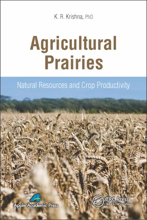 eBook - PDF
Agricultural Prairies
Natural Resources and Crop Productivity
- K. R. Krishna(Author)
- 2015(Publication Date)
- Apple Academic Press(Publisher)
CHAPTER 1 THE GREAT PLAINS OF NORTH AMERICA: NATURAL RESOURCES, PRAIRIE CROPS, AND AGRICULTURAL PRODUCTIVITY CONTENTS 1.1 Great Plains: An Introduction ............................................................. 2 1.2 Vegetation and Cropping History of Great Plains of North America ................................................................................... 14 1.3 Natural Resources with Particular Reference to Agricultural Crop Production in Great Plains ................................................................ 21 1.4 Soil Fertility Aspects of Great Plains ................................................ 26 1.5 Water Resources, Irrigation, and Crop Productivity in the Great Plains ................................................................................................. 37 1.6 Prairie Crops and Environmental Concerns ...................................... 60 Keywords ................................................................................................... 78 References .................................................................................................. 78 2 Agricultural Prairies: Natural Resources and Crop Productivity 1.1 GREAT PLAINS: AN INTRODUCTION The Great Plains of North America is geographically a vast expanse of land with fertile soils, natural prairies, agricultural cropping regions, forests, mountains, un-dulating and flat regions, rivers, and lakes. It is located in the central part of North American continent and extends for about 1.4 million mi 2 . It stretches for 3,870 km in length from Alberta, Saskatchewan, and Manitoba in the North through to Texas coast line in the South and on to small region in Mexico. The width of this ecoregion is estimated at 1,612 km starting from foothills of Rocky Mountains to Indiana in the East (Figure 1.1). Precipitation depreciates from wet regions in east (1,050 mm year −1 ) to dry arid belts of West (720 mm year −1 ).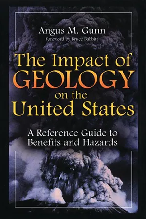 eBook - PDF
The Impact of Geology on the United States
A Reference Guide to Benefits and Hazards
- Angus M. Gunn(Author)
- 2001(Publication Date)
- Greenwood(Publisher)
9 GREAT PLAINS The Great Plains extends from the Dakotas to Texas and includes parts of 11 states: Arkansas, Colorado, Kansas, Montana, Nebraska, New Mexico, North Dakota, Oklahoma, South Dakota, Texas, and Wyoming. Topography is flat to gently rolling terrain, the remnant of a vast plain that originally stretched from the mountains eastward beyond the Missouri River. Regional uplift caused streams to cut downward, eroding the plains and isolating them from the moun- tains. Only in Wyoming does the plain still extend to the mountains. Windblown sand and silt, derived from the bed of rivers that eroded the plains, were deposited over large areas. The largest expanse of sand deposits and dune topography to be found anywhere in the Western Hemisphere is in west-central Nebraska. The water table is close to the surface in these sands. Most of the Great Plains have a dry continental climate, one of abundant sunshine, frequent winds, moderate precipitation, and high rates of evaporation. Persistent winds and high summer temperatures cause such high rates of evaporation that little is left over to recharge the groundwater system. Only in sand dune areas where water can percolate down to the water table can some precipitation be retained. GEOLOGICAL OVERVIEW Groundwater is stored in near-surface deposits of the Tertiary and Quaternary ages, whereas beneath are the bedrock units that range in age from Permian to Tertiary. These bedrock units are, for the most part, impermeable. The oldest rocks that are in contact with groundwater in the High Plains Aquifer are of Permian age, and they occupy about 12 percent of the aquifer under Kansas, Oklahoma, and Texas. These rocks consist of red beds and evaporites that were deposited in extensive, shallow, brackish to saline seas that were created by 190 THE IMPACT OF GEOLOGY ON THE UNITED STATES Figure 9.1. Morrilton, Arkansas, about 75 kilometers northwest of Little Rock, clearing away a landslide that had blocked Interstate 40.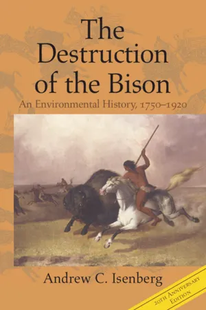 eBook - PDF
The Destruction of the Bison
An Environmental History, 1750–1920
- Andrew C. Isenberg(Author)
- 2020(Publication Date)
- Cambridge University Press(Publisher)
Between the eastern tall-grass prairie and the western shortgrass plains, tall-grass and short- grass species compete for dominance in the so-called mixed-grass zone. South of the Great Plains in the arid Sonoran desert, latitude and remoteness from mois- ture-bearing winds conspire to create a region too harsh even for the durable grasses of the American steppes. 9 Located in the center of the North American continent, in the shadow of the Rocky Mountains, the western plains climate is characterized by droughts of several years’ duration interspersed with years of above-average rainfall. 10 Climatologists chart rainfall over the centuries by studying tree rings; narrow rings indicate past dry years. Scientists conducted a number of such dendro- chronological studies in the plains in the wake of the prolonged drought of the 1930s. By studying the width of tree rings in river valleys, scientists plotted the precipitation history in the surrounding plains. A study of tree-ring growth in the vicinity of Havre, Montana, showed that between 1784 and 1949 precipita- tion varied from one-fourth of the average to two times the average. A similar tree-ring study published in 1946 found that between 1406 and 1940 the area near Bismarck, North Dakota, had 11 periods of low precipitation lasting ten The Grassland Environment 17 8 Robert E. Gabler, Robert J. Sager, Sheila M. Brazier, and Daniel L. Wise., Essentials of Physical Geography, 3d ed. (Philadelphia: Saunders, 1987), 205. 9 Paul Sears, Lands Beyond the Forest (Englewood CliVs, N.J.: Prentice-Hall, 1969), 31, 58; Carl Friedrich Kraenzel, The Great Plains in Transition (Norman: University of Oklahoma Press, 1955), 12–13; Douglas B. Bamforth, Ecology and Human Organization on the Great Plains (New York: Plenum, 1988), 53; Tom McHugh, The Time of the BuValo (Lincoln: University of Nebraska Press, 1972), 19.
- Douglas Cazaux Sackman(Author)
- 2010(Publication Date)
- Wiley-Blackwell(Publisher)
In very recent geological time humans from Asia and Europe entered these grasslands and tried to wrest a living there. Some eventually became bison-hunting Comanche and Lakota; others, Spanish, English, and German-speaking farmers, ranchers, oil drillers, and railroad builders. Each group entered the place with different assumptions and values. Yet they shared a common tendency to work collectively to exploit their environ-ment, and each group made an ecological impact, whether it was by setting fires and pushing back forests, by killing large animals to the point of extinc-tion, or by plowing up vegetation. The first historian of the North American grasslands was Walter Prescott Webb, author of The Great Plains (1931). No historian before him had made adaptation so important a theme, although forty years earlier Frederick Jackson Turner had begun to write in vaguely Darwinian terms. “The pecu-liarity of American institutions,” Turner declared, is “the fact that they have been compelled to adapt themselves to the changes of an expanding people – to the changes involved in crossing a continent, in winning a wilderness” (Turner 1961: 37). Turner’s story of a white man’s civilization evolving new institutions in response to the “wilderness” turned out to be a narrative of conquest, as “civilization” finally obliterated “nature.” Webb, on the other hand, saw a more permanent impact of nature on the settlers who entered the grasslands. His chief interest lay with his own tribe, the Anglo-Americans. The dry, treeless plains, he argued, forced them to alter their way of life – weaponry, fencing, transportation, water law, animal husbandry, and farm-ing. A grassland version of what it meant to be American emerged, forever distinct from that of the eastern United States (Webb 1931: 8–9).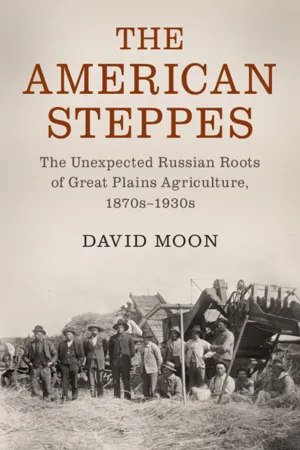 eBook - PDF
The American Steppes
The Unexpected Russian Roots of Great Plains Agriculture, 1870s–1930s
- David Moon(Author)
- 2020(Publication Date)
- Cambridge University Press(Publisher)
–. See Dan Flores, The Natural West: Environmental History in the Great Plains and Rocky Mountains (Norman: University of Oklahoma Press, ), pp. –; Andrew Isenberg, The Destruction of the Bison: An Environmental History (New York: Cambridge University Press, ); Cunfer and Waiser, eds., Bison and People. Settlement Great Plains. As the settlers converted much of the land to farms and ranches, for crops and grazing, they greatly reduced the rich biodiversity of a region once inhabited by such an array of wild life that Dan Flores called it the “American Serengeti.” The native flora of the vast areas of grasslands, with tall grasses in the east and short grasses in the west, and the colorful array of wild flowers and other plants, became increasingly rare as land was plowed up, sown with crops introduced from outside, in addition to corn, or subjected to intensive grazing. Geoff Cunfer has termed plowing grassland as “the ecological equivalent of genocide,” and the “plow-up of the Great Plains” as “the most important ecological change to emerge out of the shift from Indian to Euro-American land use.” “The act of plowing,” Cunfer continued, “alters vegetation, animal populations, water dynamics, and soil chemistry and physics in cata- strophic ways.” Russian scientists have made similar assessments of plowing up the steppes. From the perspective of the first generation of Euro-American settlers, this transformation of the plains environment entailed back-breaking labor as they engaged in the “arduous, expensive, and time-consuming process” of “sod busting”: breaking up the “hard, compact, and tenacious” soil bound by the dense and thickly matted roots of the prairie grasses that had been growing there largely undisturbed for millennia. This was not just very hard work for the settlers, but required particular techniques, special plows, and heavy oxen to pull them. eBook - ePub
- Ellen E. Wohl(Author)
- 2009(Publication Date)
- University Press of Colorado(Publisher)
The C 3 cool season grasses, such as needle-and-thread and western wheatgrass, that are more common on the northern Great Plains produce seed early in the summer before temperatures reach their annual maximum. Survival of all species of grasses improves in stands of mixed C 3 and C 4 plants that exert their maximum demand on scarce water supplies during different phases of the growing season. Slender wheatgrass at the Fromme Prairie. The grasses of the Great Plains must conserve water so carefully because the combined effects of geologic history and atmospheric circulation allow very little precipitation to reach the grasslands during much of the year. What Edwin James described in 1819 as “that great Sandy Desert, which stretches eastward from the base of the Rocky Mountains” 9 to the Platte River, results from two simple facts: the dominant movement of air across the planet is from west to east, and western North America is very mountainous. To fully understand these effects, we must look back into the unimaginably long spans of geologic history DEEP TIME Geologists commonly refer to the center of North America as the stable craton. The craton is the Earth’s oldest geologic province and covers most of Canada and the central half of the continental United States. The region has been without mountain building, metamor-phism, or volcanism—all the surface signs of the Earth’s restless interior—for more than a billion years. At the foundation of the craton is the basement composed of crystalline rocks that record a more exciting time in the geologic history of what is now central North America. The basement is a mosaic of rocks created in ancient volcanic island arcs and other fragments of the Earth’s crust that collided with one another to form the nucleus of what is now North America. These collisions and coalescences occurred between approximately 3 billion and 1.5 billion years ago, reaching a crescendo during the Great Plains Orogeny of 1.8 to 1.6 billion years ago eBook - ePub
- Dennis Ojima, Jean Steiner, Shannon McNeeley, Karen Cozzetto, Amber Childress(Authors)
- 2015(Publication Date)
- Island Press(Publisher)
Many taxa of biota, including plants, insects, and birds, have evolved the capacity to adapt to gradual environmental changes associated with climate, primarily through movement to more favorable areas. An exception to this is the mass extinction of large terrestrial mammals (North American megafauna, including mammoths, mastodons, ground sloths, horses, camels, and others) during the late Pleistocene (ca 11,500-10,500 bp). Although heavily debated, a primary hypothesis for the cause of these abrupt extinctions is the combination of human predation (the arrival of Clovis hunters to North America) coincident with major climatic and environmental changes that had already reduced population sizes (Benedict et al. 1996, Stuart 2008).WATER RESOURCESBy virtue of its scarcity, water is a critical resource in the Great Plains. Although the region is characteristically dry, humans have managed to transform the land to overcome this limitation. Since water has been a central component of that transformation, a continuous, sufficient water supply is a major concern to inhabitants. Water supply sources include surface water in rivers, streams and lakes, which comes primarily from snowmelt, shallow and deep aquifers, and rain. Drought has always been a factor in the region, with the degree and timing controlled by temperature, precipitation, and the ratio of precipitation to potential evapotranspiration (PET) (Parton et al. 1994). Barry (1983) argues that drought is the key climatic parameter of the Great Plains, as it determines the carrying capacity of the region. Water users in the Great Plains are concerned about a variety of factors related to climate variability and change. Climate change is not the most important concern in this region now, however, as there are many other stresses, including market-driven factors, policy factors, and social factors. In fact, many water users in this region are vulnerable due to the declining reward scale for farming and ranching.
Index pages curate the most relevant extracts from our library of academic textbooks. They’ve been created using an in-house natural language model (NLM), each adding context and meaning to key research topics.