Geography
Mixed Land Use
Mixed land use refers to the coexistence of different types of land use within a specific area, such as residential, commercial, and industrial activities occurring in close proximity. This concept promotes efficient use of space and resources, encourages walkability, and can create vibrant, diverse communities. Mixed land use can enhance the functionality and livability of urban areas.
Written by Perlego with AI-assistance
Related key terms
1 of 5
5 Key excerpts on "Mixed Land Use"
- eBook - ePub
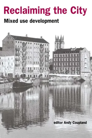
Reclaiming the City
Mixed use development
- Andy Coupland(Author)
- 2005(Publication Date)
- Routledge(Publisher)
As 1994 progressed there were intimations in the speeches of the Secretary of State John Glummer that the government, or at least the Department of the Environment, was moving towards an appreciation of the role that mixed use development might make as an agent of sustainability. By early the following year, the Department's perception that Mixed Land Use may be one factor leading to the delivery of sustainability was receiving regular promotion. At a conference in Manchester in July 1995, the Secretary of State described the existence of an emerging consensus around the view that ‘development is more sustainable if it produces a mixture of uses’. Again at pains to distance himself from the adherence to zoning practised by his predecessors, Gummer strikes a progressively more evangelical tone:Segregation of land uses, encouraged in the past, is not relevant now. The trend back to mixed usage brings a number of potential benefits. It ensures vitality through activity and diversity. It makes areas safer. It also reduces the need to travel, making people less reliant on cars, bringing welcome environmental benefits (DoE, 1995b).More recently in 1996 the government has honoured the pledge contained in the Sustainable Development Strategy to develop and publish Indicators of Sustainable Development for the United Kingdom. Produced by an interdepartmental Working Group, the report presents a set of indicators on 21 topics ranging from leisure and tourism to overseas trade. In the description of indicators relating to the re-use of land the report acknowledges that commercial and residential redevelopment within existing urban areas contributes to both their vitality and viability. Support for mixed use as an agent of sustainable development is apparent, if not altogether enthusiastic:(Mixed redevelopment) can also improve the quality of life and also accessibility for those people without a car by increasing and widening the range of services and facilities available and thereby reducing the need for people to travel to other towns for work, shopping and leisure (DoE, 1996 , p.54).Conclusion
This chapter has traced the evolution of sustainable development from its genesis as an objective in 1987, through perceptions of it as a process, to the formulation of policy to guide its practical application. In moving from being an iconic statement concerning the global environment to an expression combining ideal intent and pragmatic implementation, sustainable development has entered the everyday language of the nation. Within this setting a significant ideological shift within planning regarding the zoning of land use has occurred. Mixed use development has emerged both as a philosophy and as one acceptable element of the solution to the problem of delivery of sustainable development, replacing its earlier position as an inevitable consequence of laisser-faire - eBook - ePub
Planning in the UK
Agendas for the New Millennium
- Andy Thornley, Yvonne Rydin(Authors)
- 2018(Publication Date)
- Routledge(Publisher)
less land use heterogeneity in neighbourhoods not more. Sustainable land use policy in this respect works against the traditional market at a very fundamental level. That is not to say that it will be unsuccessful in changing the market; only that policy makers should have a realistic view of the markets they are trying to influence. Our research aims to make a statement about the demand-side of the compact city question with the belief that urban policy that disregards or glosses over the preferences of citizens will fail, either in the sense of being ignored or in the sense of creating social problems for the future. The study aims to measure householders’ demand for innovative and possibly contentious forms of urban living, as well as for more traditional sustainable living environments such as dense inner suburbs. The next section summarises the background to the issue. Subsequent sections present: a theoretical model of locational choice in which the effects of density and land-use mix are made explicit; the statistical choice model; the experimental and survey designs; initial findings; and conclusions.Background
The notion of the compact city with mixed-use neighbourhoods has gained support at all levels of political decision making since the Brundtland Report first popularised the sustainable cities debate in the mid 1980s. The Commission of the European Communities’ (CEC) Green Paper on the Urban Environment (1990), criticises “the almost clinical separation of land-uses” (p48) in modern cities and proposes that “strategies which emphasise mixed use and denser development are more likely to result in people living close to work places and the services they require from everyday life”(p60). Since the Green Paper, European, national and local policy and discussion documents have repeated the dual theme: greater densities and mixing of land-uses will significantly contribute to emissions and energy consumption reduction via shorter and possibly less frequent intra-urban car-based trips and will raise the vitality, viability and safety of urban areas. At the European level, the message has been developed strongly in the Commission-funded report “Mixed uses in buildings, blocks and quarters” (CEC 1993) and the European Sustainable Cities Report and Good Practice Guide (CEC 1995a, 1995b). At a national level, the same theme is promoted in the UK Government’s Strategy for Sustainable Development (DoE and FCo, 1994) and the Quality in Town and Country discussion document (DoE 1994). It is translated into formal guidance through planning policy guidance notes, such as PPG 13 (DoE and DoT 1994), PPG6 (DoE 1996) and PPG3 (DETR, 2000). At a local level, development briefs and strategy documents throughout the country contain pro mixed-use and densification policies. - eBook - PDF
Thinking Ecologically
The Next Generation of Environmental Policy
- Marian R. Chertow, Daniel C. Esty(Authors)
- 2008(Publication Date)
- Yale University Press(Publisher)
Land use planning in the United States has traditionally been the task of local officials who have used property zoning regulations and building codes as their principal tools. Zoning, a twentieth-century invention, was originally intended to protect property owners from their neighbors, to ward off economic, social, or environmental damage inflicted by adjacent land use. Although zoning has sometimes served these needs well, local planners have increasingly used zoning regulations to sepa-rate arbitrarily residential and commercial uses of land. As a result, the inte-gration of shops and housing, narrow streets, and dense development that attracts admiring visitors to historic urban areas such as Georgetown in Washington, D.C., is prohibited by most local codes. Yet such multi-use urban development patterns offer residents more choices in type of housing, better access and convenience, less segregation by income and class, and a greater sense of community at far less infrastructure cost. As a whole, the United States' land regulatory system is a failure. It is a policy of directed chaos—multiple programs and policies designed to address usually worthwhile goals but implemented in too small an area without regard to the health of the region and oblivious to their unintended consequences. As Aldo Leopold noted, To build a better motor we tap the uttermost powers of the human brain; to build a better country-side we throw dice. Land regulatory processes are often too narrowly focused, unevenly 64 John Turner and Jason Rylander applied, and based on inadequate information. This promotes hostility among interest groups and leaves the general public with a sense of powerlessness and disenfranchisement. Most people are unaware or do not understand how land use decisions can dramatically affect their lives and neighborhoods. Suburban jurisdictions often compete ferociously for business and development that once might have been located in the urban core. - eBook - PDF
Land Use and Land Cover Semantics
Principles, Best Practices, and Prospects
- Ola Ahlqvist, Dalia Varanka, Steffen Fritz, Krzysztof Janowicz(Authors)
- 2018(Publication Date)
- CRC Press(Publisher)
Classification System 1� Urban or built-up land 2� Agricultural land 3� Rangeland 4� Forest 5� Water 6� Wetland 7� Barren 8� Tundra 9� Perennial snow 15 Classification Systems and Land Planning 6� Compatibility or conflict between land uses 7� Competing demands for land having certain characteristics 8� Compatibility of city and county plans 9� Supply and location of land for rural uses 10� Preservation of land for agricultural and forestry uses 11� The character and appearance of neighborhoods 12� Compatibility of land use with supportive systems such as transpor-tation and sewerage 13� Protection of natural features and waterways from the impact of development 14� Provision of open spaces within the urban environment From this list of issues, there are several aspects of land use planning that are important beyond the change in land use types� Three major themes can be identified: the relationship between land use types, the connection to infrastructure services, and the demands for land and governmental ser-vices� For this analysis of land use/land cover classification, three major land uses within the plan will be explored: residential, agriculture, and forestry� The residential portion of the land use chapter identified five major catego-ries of residential: low density (residential lots ranging from 2,500 to 30,000 sq� ft�), medium density (up to 12 units/acre), medium high density (up to 18 units/acre), high density (up to 25 units/acre), and special high density for high-rise multifamily housing (up to 60 units/acre)� Overall, there are six residential goals as follows: 1� Protect the character of existing low density neighborhoods� 2� Provide a variety of living environments� 3� Provide for development within the carrying capacity of hillsides and environmentally sensitive areas� 4� Provide opportunities for those who want alternatives to the single family house and yard� 5� Provide for lower cost, energy-efficient housing� 6� Provide for efficient use of land and public facilities, including greater use - eBook - PDF
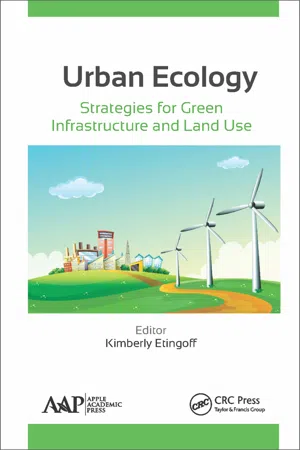
Urban Ecology
Strategies for Green Infrastructure and Land Use
- Kimberly Etingoff(Author)
- 2015(Publication Date)
- Apple Academic Press(Publisher)
PART IV PLANNING TOOLS FOR ENHANCING URBAN ECOLOGY CHAPTER 11 Multifunctional Urban Agriculture for Sustainable Land Use Planning in the United States SARAH TAYLOR LOVELL Multifunctional Urban Agriculture for Sustainable Land Use Planning in the United States. © Lovell ST. Sustainability 2010 ,2 (2010). doi:10.3390/su2082499. Licensed under a Creative Commons At-tribution 3.0 Unported License, http://creativecommons.org/licenses/by/3.0. 11.1 INTRODUCTION In the introduction to this Special Issue on Land Use and Sustainability, guest editor Brian Deal poses the question: “What are the approaches, methods and tools needed to shape the development of human habitats and ensure their sustainability into an uncertain future?” This review of the literature on urban agriculture offers a strong argument that one answer to this question can be found in the intentional integration of multifunctional agriculture into city planning. Urban agriculture has been defined as “… the growing, processing, and distribution of food and nonfood plant and tree crops and the raising of livestock, directly for the urban market, both within and on the fringe of an urban area” ([1]; p. 4). These agricultural activities take many forms and occur at multiple scales in cities through-out the world, responding to the needs and preferences of urban residents. 252 Urban Ecology: Strategies for Green Infrastructure and Land Use In the U.S., however, agriculture is typically considered to be a land use activity associated with the rural landscape, where vast areas of farmland can support large-scale production systems. However, growing evidence suggests that incorporating appropriate types of agriculture into the urban environment will greatly improve the sustainability of U.S. cities, particu-larly if these systems are designed to take advantage of the resources and markets available there [2,3].
Index pages curate the most relevant extracts from our library of academic textbooks. They’ve been created using an in-house natural language model (NLM), each adding context and meaning to key research topics.
